[includeme] shortcode. This message is shown only to administrators.
[Ed: Paragraphs in italics are taken verbatim or heavily paraphrased from Jack Parsell’s book “Tri-State Corners in the United States” which is the basis for this guide.]
Tri-state Pointing requires some venturing into remote areas across inhospitable terrain and private property (eg, the landowner of #24 AL-FL-GA doesn’t like folks roaming his property with tree stands he rents out to hunters). As tri-pointer Bill Wentzel says “Tri-pointing is not for wusses“.
Introduction
While pursuing the highest peaks in each state, you might consider visiting other geographic locations such as the lowest points or the tri-points, aka trifiniums. These are places where three States come together at a common point. Almost everyone is familiar with Four Comers in the southwestern U.S., where Utah, Colorado, Arizona and New Mexico meet at a spot in the Navajo Indian Reservation. However, not many people realize that there are sixty-one other spots where three States join. Of this total of sixty-two, thirty-eight either have markers or should have markers on land. The rest are in the middle of rivers, streams or lakes where no identifying marker can be placed.
This endeavor could be extended to include tri-points along the U.S.-Canadian and U.S.-Mexican borders. There are eleven locations where two U.S. States meet a Canadian province, and seven more where one State hooks up with two provinces. Similarly, at three spots, two U.S. States join at a Mexican State, and at five other locations it is two Mexicans adjoining one U.S. State. This gives a grand total of twenty-six locations of which only ten are on dry land.
Jack Parsell
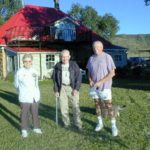
 Jack Parsell, tenth person to have climbed the 50 summits and first to have visited the 50 lowest points, decided to visit the 38 dry, land tri-point locations. On July 29, 1997, Jack and friends reached the survey marker at tri-point #5 ID-MT-WY which allowed him to complete his visits to all 38 of the dry land tri-points. Along the way Jack collected notes and photos and published a book “Tri-State Corners in the United States”.
It was Jack’s hope that his guide book will encourage others to visit these geographical locations, many of which are of significant historical interest. They vary from the remoteness of #2 ID-NV-OR and the difficult access of #5 ID-MT-WY to the ease of finding others such as #20 AR-MO-OK and #21 AR-LA-TX.
Resources
There are several websites with a focus on tri-pointing with maps, photos, updates, etc.
- The Corner Corner – Brian Butler’s adventures in dry and wet tri-pointing.
- Peakbagging – Richard Carey has done extensive research on Tri-State Corners and provides several tables including topo data and benchmark info.
- The Trek Stop – Bill Wentzel’s blog has several tri-point trip reports. [Ed: so extensive you need to click on “Older Posts” a few times to see them all].
- Bill Wentzel on Flickr – Bill Wentzel has several albums related to tri-point trips.
- Tri Point & Corner Markers – Jimmy Emerson has been posting photos of his tri-pointing adventures to Flickr.
There are several websites with random posts on tri-pointing including but not limited to:
- Wikipedia has a page on “Tri-state area” which lists the tri-points with brief notes.
- USGS publication 909 provides history and details on “Boundaries of the United States and the several States”.
- Waymarking.com has a list of tri-points with brief notes and photos.
- http://www.usends.com – Dale Sanderson has detailed history and trip reports for Colorado’s tripoints [menu Other -> State Corners].
- http://www.ctmq.org/ct-ma-ri-tri-point/ – Detailed trip report for the CT-MA-RI tri-point.
- http://www.kansastravel.org/threecorners.htm – Trip report for the CO-KS-NE tri-point.
- http://www.kimballne.org/visitors/tri-state_marker.php – Information about the CO-NE-WY tri-point.
There are also several forums related to tri-pointing:
- View From The Top has a thread on New England Tri-State markers.
- Yahoo Groups! BoundaryPoint – an archived forum on boundary points.
- Yahoo Groups! boundarypointpoint – an active “open forum for the ongoing & overflowing proceedings of boundarypoint”.
- Yahoo Groups! BorderPoint – an active “clearing house for information related to international (and state/provincial) boundaries and frontiers”.
Tri-pointing is even making it into mainstream media:
- Delaware Online, 2013 – Virginia and Dick Baldwin Thanksgiving access to DE-ME-PA.
- The Washington Post, Sept, 2015 – Cornering America’s tri-points – talks about tri-points and has a great interactive map of the 62 tri-points.
- Denver Post, July 27, 2017 – Travelers go where three, four states touch – talks about Brian Butler’s tri-pointing adventures
- Providence Journal, July 27, 2017 – https://www.usnews.com/news/best-states/connecticut/articles/2017-07-27/hobby-has-travelers-looking-for-spots-where-3-states-touch – talks about Brian Butler’s tri-pointing adventures
Highpointers Club Benefits
The club has several links in our “Downloads” section related to tri-pointing:
- Jack Parsell’s guide book “Tri-State Corners in the United States”
3rd Edition, 4th Revision (Feb, 2002) - Frank Sutman and other Highpointer Club members have updated Jack’s guide book
4th Edition (May, 2017)
Through the “Apex to Zenith” newsletter, club members receive continuing coverage on tri-points. Updates (access, monument status, etc) are found in the newsletter and posted online in this guide. A small sample of articles are:
Only admnistrator owned posts can execute the[includeme] shortcode. This message is shown only to administrators.
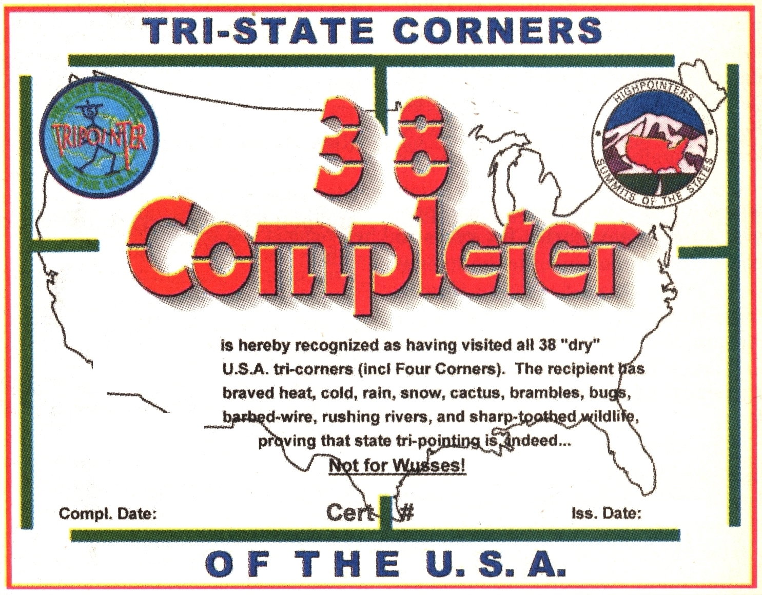
Club member Bill Wentzel has designed a completion certificate (see Issue #82 – Third Quarter 2008) which is presented to completers at our annual convention meetings. The criteria for earning a completion certificate are:
• Complete all 38 tri-points accessible by land OR
• Complete all 24 tri-points accessible by water OR
• Complete all 18 US-Canada tri-points and all 8 US-Mexico tri-points
 That means if you complete all 87 tri-points associated with US states, you will earn 3 completion certificates! In addition you can download this “Tri-point Score Card” (MS Word) to keep track of your completion dates. You can track your progress against other club members at our “Tri-point Completers” page.
 Bill Wentzel has also designed a Tripointing patch. You can buy this patch by contacting John Mitchler (jdmitchler@aol.com).
About this Guide
This page, “US Tripoint Guide”, is an aggregation of multiple sources. It is largely based on Jack’s guide book and can be viewed as his Fourth+ Edition. It includes several updates/clarifications to preferred access routes since Jack finished his adventures. It also links in content from Peakbagging, Wikipedia and The Corner Corner among others – online resources mentioned above. Please contact us at guides@highpointers.org if you have suggestions or updates.
This page contains three major sections below. The first contains a large table which lists all the tri-points: the 38 dry land tri-points, the 24 wet water tri-points, the 18 U.S.-Canada tri-points and the 8 U.S.-Mexico tri-points.
The middle section contains an interactive map showing the location of all the tri-points. Below it is an information panel. If you click a map icon or a tri-point link, the tri-point’s details (general info, trip reports and updates, photos, etc.) will appear in the information panel. The “View”/”Print” links will open the tri-point’s details in a separate window/tab for clean printing to take with you. The last section is a series of lists in case you are only interested in certain types of tri-points.
Naming convention
We have moved away from Jack’s naming convention and use the alphabetical order found on most tri-point related websites. We still adhere to Jack’s numbering system which arbitarily starts at the western-most tri-point and proceeds easterly. This has been extended to handle the wet tri-points, U.S.-Canada and U.S.-Mexico tri-points which Jack originally didn’t number.
Note that Four Corners (AZ-CO-NM-UT) is really four tri-State points in one location, but is counted as only one spot for our purposes. The District of Columbia at its twin junctions with Virginia and Maryland is counted as only one location. Also, one of the wet ones, Missouri – Kentucky – Tennessee actually consists of three separate locations because of an S bend in the Mississippi River which isolates a small area of Kentucky.
Please note that we adhere to Jack’s categorization of land versus water tri-points. Due to drought, or rivers changing course or other factors, some tri-points may “swap” categories. For example, #65 AR-LA-MS is currently dry while #34 NJ-NY-PA is currently wet. We provide links to satellite and topo maps for each tri-point where you can verify their current land/water condition.
Only admnistrator owned posts can execute the
[includeme] shortcode. This message is shown only to administrators.
This table provides summary information about all the tri-points.
ID – Jack’s numbering system extended to include all tri-points.
the link goes to the corresponding “The Corner Corner” page
States – Tri-point name
the link goes to our details section
Type – whether it is land-based (dry), water-based (wet) or involves Canada/Mexico
the link goes to our summary lists at the bottom
Pvt – whether the tri-point is privately owned. Please contact owner before going.
Elev – the elevation in feet
the link goes to our Tripoint Discussion forums
Dist – the distance (from car or from shore) to the tri-point in miles
[You may re-sort this table by clicking the small arrows found in the column headers.]
[includeme] shortcode. This message is shown only to administrators.
[Canada: AB = Alberta, BC = British Columbia, MB = Manitoba, NB = New Brunswick, ON = Ontario, QC = Quebec, SK = Saskatchewan, YT = Yukon Territory]
[Mexico: BCN = Baja California, CHH = Chihuahua, COA = Coahuila, NLE = Nuevo Leon, SON = Sonora, TAM = Tamaulipas]
Only admnistrator owned posts can execute the
[includeme] shortcode. This message is shown only to administrators.
Only admnistrator owned posts can execute the [includeme] shortcode. This message is shown only to administrators.
Only admnistrator owned posts can execute the
[includeme] shortcode. This message is shown only to administrators.
This final section is for those people who like lists. We separate the tri-points into those accessible by land, those accessible by water, those which involve Canada and those which involve Mexico. We also provide an index sorted by state of its tri-points.
Tripoints Accessible by Land:
- California-Nevada-Oregon
- Idaho-Nevada-Oregon
- Idaho-Nevada-Utah
- Arizona-Nevada-Utah
- Idaho-Montana-Wyoming
- Idaho-Utah-Wyoming
- Colorado-Utah-Wyoming
- Arizona-Colorado-New Mexico-Utah (Four Corners)
- Montana-North Dakota-South Dakota
- Montana-South Dakota-Wyoming
- Nebraska-South Dakota-Wyoming
- Colorado-Nebraska-Wyoming
- Colorado-Kansas-Nebraska
- Colorado-New Mexico-Oklahoma
- New Mexico-Oklahoma-Texas
- Colorado-Kansas-Oklahoma
- Minnesota-North Dakota-South Dakota
- Iowa-Minnesota-South Dakota
- Kansas-Missouri-Oklahoma
- Arkansas-Missouri-Oklahoma
- Arkansas-Louisiana-Texas
- Indiana-Michigan-Ohio
- Alabama-Georgia-Tennessee
- Alabama-Florida-Georgia
- Georgia-North Carolina-Tennessee
- Georgia-North Carolina-South Carolina
- Kentucky-Tennessee-Virginia
- North Carolina-Tennessee-Virginia
- Kentucky-Virginia-West Virginia
- Maryland-Pennsylvania-West Virginia
- Maryland-Virginia-West Virginia
- District of Columbia-Maryland-Virginia (32.1 North) (32.2 South)
- Delaware-Maryland-Pennsylvania
- New Jersey-New York-Pennsylvania
- Connecticut-Massachusetts-New York
- Massachusetts-New York-Vermont
- Massachusetts-New Hampshire-Vermont
- Connecticut-Massachusetts-Rhode Island
- Alaska-British Columbia-Yukon Territory
- British Columbia-Idaho-Washington
- British Columbia-Idaho-Montana
- Alberta-British Columbia-Montana
- Alberta-Montana-Saskatchewan
- Montana-North Dakota-Saskatchewan
- Manitoba-North Dakota-Saskatchewan
- Maine-New Hampshire-Quebec
- Arizona-New Mexico-Sonora
- Chihuahua-New Mexico-Sonora
Tripoints Accessible by Water:
- Idaho-Oregon-Washington
- Arizona-California-Nevada
- Iowa-Nebraska-South Dakota
- Iowa-Missouri-Nebraska
- Kansas-Missouri-Nebraska
- Oklahoma-Arkansas-Texas
- Michigan-Minnesota-Wisconsin
- Iowa-Minnesota-Wisconsin
- Illinois-Iowa-Wisconsin
- Illinois-Iowa-Missouri
- Illinois-Kentucky-Missouri
- Kentucky-Missouri-Tennessee (62.1 West), (62.2 Middle), (62.3 East)
- Arkansas-Missouri-Tennessee
- Arkansas-Mississippi-Tennessee
- Arkansas-Louisiana-Mississippi
- Alabama-Mississippi-Tennessee
- Illinois-Michigan-Wisconsin
- Illinois-Indiana-Michigan
- Illinois-Indiana-Kentucky
- Indiana-Kentucky-Ohio
- Kentucky-Ohio-West Virginia
- Ohio-Pennsylvania-West Virginia
- Delaware-New Jersey-Pennsylvania
- Connecticut-New York-Rhode Island
- Manitoba-Minnesota-North Dakota
- Manitoba-Minnesota-Ontario
- Michigan-Minnesota-Ontario
- Michigan-Ontario-Ohio
- Ohio-Ontario-Pennsylvania
- New York-Ontario-Pennsylvania
- New York-Ontario-Quebec
- New York-Quebec-Vermont
- New Hampshire-Quebec-Vermont
- Maine-New Brunswick-Quebec
- Arizona-Baja California-California
- Arizona-Baja California-Sonora
- Chihuahua-New Mexico-Texas
- Chihuahua-Coahuila-Texas
- Coahuila-Nuevo Leon-Texas
- Nuevo Leon-Tamaulipas-Texas
United States-Canada Tripoints:
- Alaska-British Columbia-Yukon Territory
- British Columbia-Idaho-Washington
- British Columbia-Idaho-Montana
- Alberta-British Columbia-Montana
- Alberta-Montana-Saskatchewan
- Montana-North Dakota-Saskatchewan
- Manitoba-North Dakota-Saskatchewan
- Manitoba-Minnesota-North Dakota
- Manitoba-Minnesota-Ontario
- Michigan-Minnesota-Ontario
- Michigan-Ontario-Ohio
- Ohio-Ontario-Pennsylvania
- New York-Ontario-Pennsylvania
- New York-Ontario-Quebec
- New York-Quebec-Vermont
- New Hampshire-Quebec-Vermont
- Maine-New Hampshire-Quebec
- Maine-New Brunswick-Quebec
United States-Mexico Tripoints:
- Arizona-Baja California-California
- Arizona-Baja California-Sonora
- Arizona-New Mexico-Sonora
- Chihuahua-New Mexico-Sonora
- Chihuahua-New Mexico-Texas
- Chihuahua-Coahuila-Texas
- Coahuila-Nuevo Leon-Texas
- Nuevo Leon-Tamaulipas-Texas
Tripoint Index by State:
- Alabama – AL-FL-GA, AL-GA-TN, AL-MS-TN
- Alaska – AK-BC-YT
- Arizona – AZ-BCN-CA, AZ-BCN-SON, AZ-CA-NV, AZ-CO-NM-UT, AZ-NV-UT, AZ-NM-SON
- Arkansas – AR-LA-MS, AR-LA-TX, AR-MO-OK, AR-MO-TN, AR-MS-TN, AR-OK-TX
- California – AZ-BCN-CA, AZ-CA-NV, CA-NV-OR
- Colorado – AZ-CO-NM-UT, CO-KS-NE, CO-KS-OK, CO-NE-WY, CO-NM-OK, CO-UT-WY
- Connecticut – CT-MA-NY, CT-MA-RI, CT-NY-RI
- Delaware – DE-MD-PA, DE-NJ-PA
- District of Columbia – DC-MD-VA (North), DC-MD-VA (South)
- Florida – AL-FL-GA
- Georgia – AL-FL-GA, AL-GA-TN, GA-NC-TN, GA-NC-SC
- Hawaii – none
- Idaho – BC-ID-MT, BC-ID-WA, ID-MT-WY, ID-NV-OR, ID-NV-UT, ID-OR-WA, ID-UT-WY
- Illinois – IL-IA-MO, IL-IA-WI, IL-KY-MO, IL-IN-KY, IL-IN-MI, IL-MI-WI
- Indiana – IL-IN-KY, IL-IN-MI, IN-KY-OH, IN-MI-OH
- Iowa – IL-IA-MO, IL-IA-WI, IA-MN-SD, IA-MN-WI, IA-MO-NE, IA-NE-SD
- Kansas – CO-KS-NE, CO-KS-OK, KS-MO-NE, KS-MO-OK
- Kentucky – IL-IN-KY, IL-KY-MO, IN-KY-OH, KY-MO-TN (West), KY-MO-TN (Middle), KY-MO-TN (East), KY-OH-WV, KY-TN-VA, KY-VA-WV
- Louisiana – AR-LA-MS, AR-LA-TX
- Maine – ME-NB-QC, ME-NH-QC
- Maryland – DE-MD-PA, DC-MD-VA (North), DC-MD-VA (South), MD-PA-WV, MD-VA-WV
- Massachusetts – CT-MA-NY, CT-MA-RI, MA-NH-VT, MA-NY-VT
- Michigan – IL-MI-WI, IL-IN-MI, IN-MI-OH, MI-MN-ON, MI-MN-WI, MI-ON-OH
- Minnesota – IA-MN-SD, IA-MN-WI, MB-MN-ND, MB-MN-ON, MI-MN-ON, MI-MN-WI, MN-ND-SD, Hill of Three Waters
- Mississippi – AR-MS-TN, AR-LA-MS, AL-MS-TN
- Missouri – AR-MO-OK, AR-MO-TN, IL-IA-MO, IL-KY-MO, IA-MO-NE, KS-MO-NE, KS-MO-OK, KY-MO-TN (West), KY-MO-TN (Middle), KY-MO-TN (East)
- Montana – AB-BC-MT, AB-MT-SK, BC-ID-MT, ID-MT-WY, MT-ND-SK, MT-ND-SD, MT-SD-WY, Triple Divide Peak
- Nebraska – CO-KS-NE, CO-NE-WY, IA-MO-NE, IA-NE-SD, KS-MO-NE, NE-SD-WY
- Nevada – AZ-CA-NV, AZ-NV-UT, CA-NV-OR, ID-NV-OR, ID-NV-UT
- New Hampshire – ME-NH-QC, MA-NH-VT, NH-QC-VT
- New Jersey – DE-NJ-PA, NJ-NY-PA
- New Mexico – AZ-CO-NM-UT, AZ-NM-SON, CHH-NM-SON, CHH-NM-TX, CO-NM-OK, NM-OK-TX
- New York – CT-MA-NY, CT-NY-RI, MA-NY-VT, NJ-NY-PA, NY-ON-PA, NY-ON-QC, NY-QC-VT
- North Carolina – GA-NC-TN, GA-NC-SC, NC-TN-VA
- North Dakota – MB-MN-ND, MB-ND-SK, MT-ND-SK, MT-ND-SD, MN-ND-SD
- Ohio – IN-MI-OH, IN-KY-OH, KY-OH-WV, MI-ON-OH, OH-ON-PA, OH-PA-WV
- Oklahoma – AR-MO-OK, AR-OK-TX, CO-KS-OK, CO-NM-OK, KS-MO-OK, NM-OK-TX
- Oregon – CA-NV-OR, ID-NV-OR, ID-OR-WA
- Pennsylvania – DE-MD-PA, DE-NJ-PA, MD-PA-WV, NJ-NY-PA, NY-ON-PA, OH-ON-PA, OH-PA-WV, Potter Triple Divide
- Rhode Island – CT-MA-RI, CT-NY-RI
- South Carolina – GA-NC-SC
- South Dakota – IA-MN-SD, IA-NE-SD, MN-ND-SD, MT-ND-SD, MT-SD-WY, NE-SD-WY
- Tennessee – AL-GA-TN, AL-MS-TN, AR-MS-TN, AR-MO-TN, GA-NC-TN, KY-MO-TN (West), KY-MO-TN (Middle), KY-MO-TN (East), KY-TN-VA, NC-TN-VA
- Texas – AR-LA-TX, AR-OK-TX, CHH-NM-TX, CHH-COA-TX, COA-NLE-TX, NM-OK-TX, NLE-TAM-TX
- Utah – AZ-CO-NM-UT, AZ-NV-UT, CO-UT-WY, ID-NV-UT, ID-UT-WY
- Vermont – MA-NH-VT, MA-NY-VT, NH-QC-VT, NY-QC-VT
- Virginia – KY-TN-VA, NC-TN-VA, KY-VA-WV, MD-VA-WV, DC-MD-VA1, DC-MD-VA2
- Washington – BC-ID-WA, ID-OR-WA
- West Virginia – KY-VA-WV, MD-PA-WV, MD-VA-WV, KY-OH-WV, OH-PA-WV
- Wisconsin – IL-IA-WI, IL-MI-WI, IA-MN-WI, MI-MN-WI
- Wyoming – ID-MT-WY, ID-UT-WY, CO-UT-WY, MT-SD-WY, NE-SD-WY, CO-NE-WY
Whew! You made it to the bottom of the guide. If you have suggestions or updates, please contact us – guides@highpointers.org.
Appendix – Triple Divide Points
Keeping with the theme of “tri” points, we can consider “triple divide” points. These are points where two hydrological (drainage) divides meet. The most famous is Triple Divide Peak in Montana – the “Crown of the Continent”. This is where the Continental (Great) Divide meets with the Laurentian (Northern) Divide and divides water from the Pacific Ocean (Columbia River), Atlantic Ocean (Mississippi River) and Arctic Ocean (Hudson Bay). NOTE: Depending on whether Hudson Bay is part of the Arctic Ocean or Atlantic Ocean, Snow Dome in Canada is the hydrological apex. Club founder Jack Longacre wanted to paddle the three watersheds of Tripe Divide Peak. His book “Keep Paddlin’” details his adventures from the peak to the Pacific Ocean.
I have overlaid the major hydrological divides and their associated triple divide points on our map. This is based upon a KML file by “Dr Science”, NOAA photo of Gulf of Mexico drainage, USGS Watershed Boundary Dataset, Atlas of Canada MCR4055 and topo maps.
Appendix – Interview with Jack Parsell
[Ed: This is an excerpt of an interview with Jack and Joyce Parsell by Roger Rowlett. The full interview was featured in Issue #60 – First Quarter 2003 of the “Apex to Zenith” newsletter.]
What got you interested in doing a book on tri-states?
They were always a curiosity. But when Clark, Joyce and I were coming back from a highpointing trip out West in 1990, we stopped at the three tri-state points in the Oklahoma panhandle. Later, after doing most of them I decided to write the book since there was growing interest in tri-points.
Where did you get your information?
The best reference is a government pamphlet, “Boundaries of the United States and the Several States, Geological Survey Paper #909.” The edition I have is 1976 and I don’t think it’s been updated. It used to cost $5.20. I don’t know what it costs now. It has a tremendous amount of information on the boundary treaties and it goes into the boundary surveys for each state. There’s also another book on the Principal Meridians. The Principal Meridians are the starting points for surveys. Some of them have handsome monuments. But the book itself is very technical and would be of interest mostly to surveyors.
There’s of course a tremendous amount of information on the web.
There’s Brian Butler’s “Corner Corner” Website where you can incidentally downloand my tri-point book. http://www.bjbsoftware.com/corners/
And there’s the BoundaryPoint Yahoo discussion group. I have posted a lot of information there including a report about the Oklahoma 2002 convention. http://groups/yahoo.com/group/BoundaryPoint/
Do you have a favorite tri-point?
We liked the ones in the mountains in the West. There’s the Colorado-Wyoming-Utah. It’s up around 8400 feet. It’s a lousy road but we were lucky to get there with a two-wheel drive. Idaho-Wyoming-Montana is on the Continental Divide in Yellowstone Park. It was still a desolate spot since it hadn’t totally recovered from the 1988 Yellowstone fire when we visited in 1997.
What do people think when you visit?
Most people are very friendly and very cooperative. Once we had a property owner come at us with a dog and shotgun at Maryland-Pennsylvania-Delaware. After we told him what we were doing, he showed us the spot.
You have also visited several European intersections.
Many Europeans are very passionate about the points and boundaries. They have a lot of boundary quirks that interest them greatly. There are exclaves (land that is surrounded by another country); enclaves (the surrounded land) and condominiums (land that is jointly owned). For example, there’s an island between France and Spain where the border runs down the middle. They take turns administering each year. I don’t know of any place in the U.S. that is like that.

 Like us on Facebook
 Follow us on Twitter
 Follow us on Instagram
 Watch us on Youtube
 Unofficial Highpointers Group
 Americasroof Forum


