Trip Report - Oct 26, 1995 - Jack Parsell
ACCESS ROUTE: This is the most remote of all the tri-points. Access is from Winnemucca, NV via either Paradise Valley or McDermott. We went in from Paradise Valley and returned via McDermott Indian Reservation. A high clearance vehicle is required, and for a few sections of the road a 4WD is advisable. Since it is over 200 miles round trip from Winnemucca, a full day should be planned for the trip.
From Winnemucca, drive 40 miles N to Paradise Valley. Continue E and N on gravel and dirt roads 49 miles to a signed junction. Turn E and proceed on a poor road about 16 miles to the Nevada- Oregon fence line. Then turn right, and follow a very rough jeep track along the fence on the Oregon side, for about another mile to the tri-state monument which is on the Oregon side of the fence line.
The McDermott route leaves US 95 approximately 70 miles N of Winnemucca and 3.8 miles S of the Oregon line. Heading E you will cross the Indian Reservation and follow up the Quinn River valley. At about 23 miles from US 95 you will come to the signed junction mentioned above. From that point follow the directions already given.
Since this is a very sparsely traveled area it is advisable to be prepared for camping out in the event of vehicle problems. The best location for renting a 4WD pickup is the GMC dealer, Bosch Motors, 1205 E. Winnemucca Blvd., Winnemucca, NV, 89445.
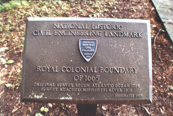
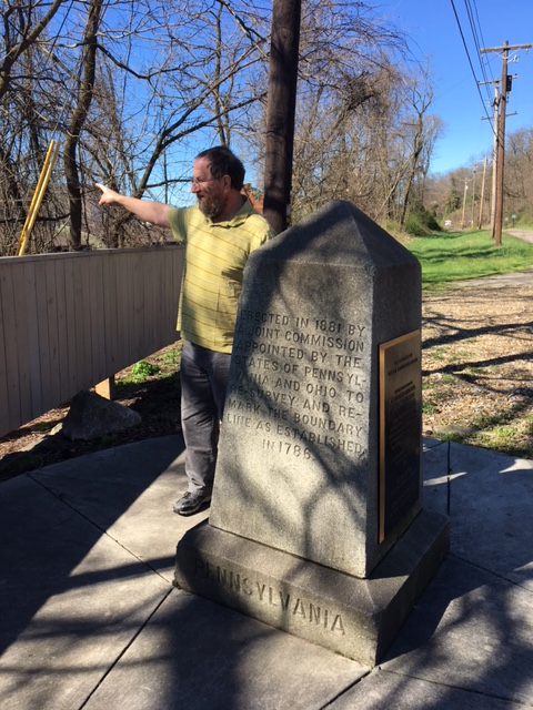
The sign below the monument is:
This monument marks the point established by Daniel G. Majors, U.S. Astronomer and Surveyor in December 1867, on the 42nd parallel north.
As determined from numerous observations of the stars for latitude this point is 124 miles, 17 chains and 2 links distance south of the initial point which was determined at the confluence of the Owyhee River with the Snake River.
This position identifies the southwest corner of Idaho, the southeast corner of Oregon and the north boundary of Nevada.
Note the N is for Nevada. The other two faces of the triangular marker are marked O and I.
Update - Summer, 2006 - Bob Whitney
The road in from the MCDermott Indian Reservation definitely warrants using a 4WD vehicle. After our visit, I looked at a Nevada gazetteer and the coding for the roads going through Paradise Valley suggest a 4WD is not needed. That is certainly the case from where these two routes merge, until you reach the "poor road" along the NV/OR fence line.
ACCESS ROUTE: From Burley, Idaho take route 27 for 21 miles S to Oakley. Turn R (West) onto Main St., then L (South) on College St. which at 1.5 mi. becomes Goose Creek Rd. Bear left at the turnoff to Goose Creek Reservoir, then up to the top of a hill and on down to Goose Creek. Follow the creek to the UT line at about 21 mi. S of Oakland at a cattle guard (no sign). Stop about 1 mi. farther at the Fred Bedkey ranch and get permission to go on the property. From the UT line it is 3.1 mi. to where a gate blocks a road at a bend in the main road. This farm road, which bears off to the right, is part of the old Emigrant/California Trail. Park and hike 0.7 mi. to the NV border. Then hike 2.1 miles N in Nevada to the tri-point along the NV-UT fence line, wading Goose Creek, shortly after starting out, or in high water, use the bridge about 1/2 mi. W, then return to the NV-UT line. Check with local residents for other possible routes.
The state of Utah had a new granite monument made for this location in 1998. After much research the BLM cadastral survey office found the exact corner was beneath the old 1873 marker at the intersection of the state line fences. Evidence of burnt wood chips placed below the old marker by Mr. Majors were discovered. The new monument was installed and a dedication ceremony was held on October 2, 1999.
ACCESS ROUTE: From the Littlefield, AZ exit from Interstate 15 go N through the village of Beaver Dam on the route to Shivwits, UT. About 6 1/2 miles N of Beaver Dam pass under a high-voltage power line. From the power line it is mile to the AZ - UT line, and another mile from the state line to an extreme L (SW) turnoff on a dirt road that goes back into AZ and down into Beaver Dam Wash. Park car just before reaching the wash. Wash may be completely dry, and except after heavy rains, there is usually little water in it.
Hike N and a little W in the wash a little more than 1 1/2 miles to the UT fence line. Follow the fence line W about 2 to 3 miles depending on where you hit the fence on the first leg of your hike. A rough trail on the AZ side of the fence goes up and down the banks of several dry washes. Initial Mesa will be on your right, 200 ft. higher than the tri-point. Initial Monument set in 1901 is a red sandstone marker at the fence line where you enter NV. An earlier marker set in 1870 was 1.4 mi. too far N. A USGS bronze survey disc is about 750 ft. SE of Initial Monument.
For an alternate route, which allows driving a 4WD vehicle very close to the monument, contact Roger Bundy, 259 Prickley Pear Drive, Washington, UT 84780. This 20 mile drive leaves the road to Beaver Dam just N of Interstate 15 and proceeds W and N in Arizona and Nevada, finally cutting back SE to the tri-point.
Update - Oct 20, 2002 - Brian J Butler
You can view the trip report at The Corner Corner.
Update - Summer, 2006 - Bob Whitney
Frank Sargent and I had an easy time driving the alternate route described by Jack. We drove a 4WD SUV. As the SE diagonal shown in Jack's map veers to the right, we took a left turn and shortly cane to a good parking area overlooking a relative highpoint. We descended from that point and used our GPS to reach Initial Monument. The walking was easy except for having to crawl under a barbed wire fence with low clearance. We did not find any place to easily climb over or between the barbed wires. There may be an approach by using a din road which parallels the NV/AZ border going north. We did not check out this road or if there were any open gates to get through the likely fences.
Update - Aug 12, 2008 - Jeff Senten
[Ed: Map provided by Bill Wentzel at The Trek Stop.]
• If you are coming from St. George, Utah it is about 26.5 miles south on I-15 to Littlefield, Arizona. Take the exit and head north.
• You will head north on highway 91 for a very short distant of .22 miles if you are coming from Mesquite or it will be .08 mile (450 ft), if you are coming from St. George, UT.
• Turn left and get on Littlefield Interchange Road. This road will wind around, but stay on it for about 3/4 of a mile where the road will take a sharp right hand turn. This is where you will need to get off on to the dirt road and head west. This is where we begin.
• We will need to stay on the main road for about 4.19 mile or just under 4 1/4 miles where we need to make a 90 degree turn to the right and head North.
• Now travel little over 3 1/2 miles (3.58) and stay to the left of the road. Do not take the right fork. Stay on the main dirt road and stay left. Some landmarks are big power-lines. This is a good marker in case you get lost.
• At the 5.32 mile mark from the first turn off heading north, stay to the right and you will then need to make a sharp left turn. Just stay on the main dirt road.
• Around the 6 1/2 mile mark, we should be crossing a small wash that is a 4 way. Stay straight on the main road.
• Just little over the 7.0 mile mark, you will need to make a right coming around a hill, there you will see remnants of an old cattle coral. Head toward that.
• You can go straight, but I would suggest going to the left around the coral and the make a right on the wash and head up. We should be around 7.33 miles.
• This wash is now called the Sand Hollow Wash Road. Let's stay on this for a while.
• Traveling little over 11 3/4 miles from where we start heading straight north, we will come to a fence line. This is where we need to head east (right) and follow this ATV trail. This trail will fit most rigs, but I would not suggest anything larger that the K5 blazers or the big bronco fords, suburbans. Now we are heading East.
• Just about 2 miles we will have already hit some pretty good washes, but there is this one that will really articulate the body out of your rig. This is where we can get stuck, but no worries, Tri-Pointing is not for wussies!!! Right!!! Go for it!!!
• So just little over 2 1/4 miles from the turn off we are at the NV/UT/AZ/ tripoint. Don't forget to sign the guest book in the geocache box.
• To get back, reverse the order.
Happy Trails!
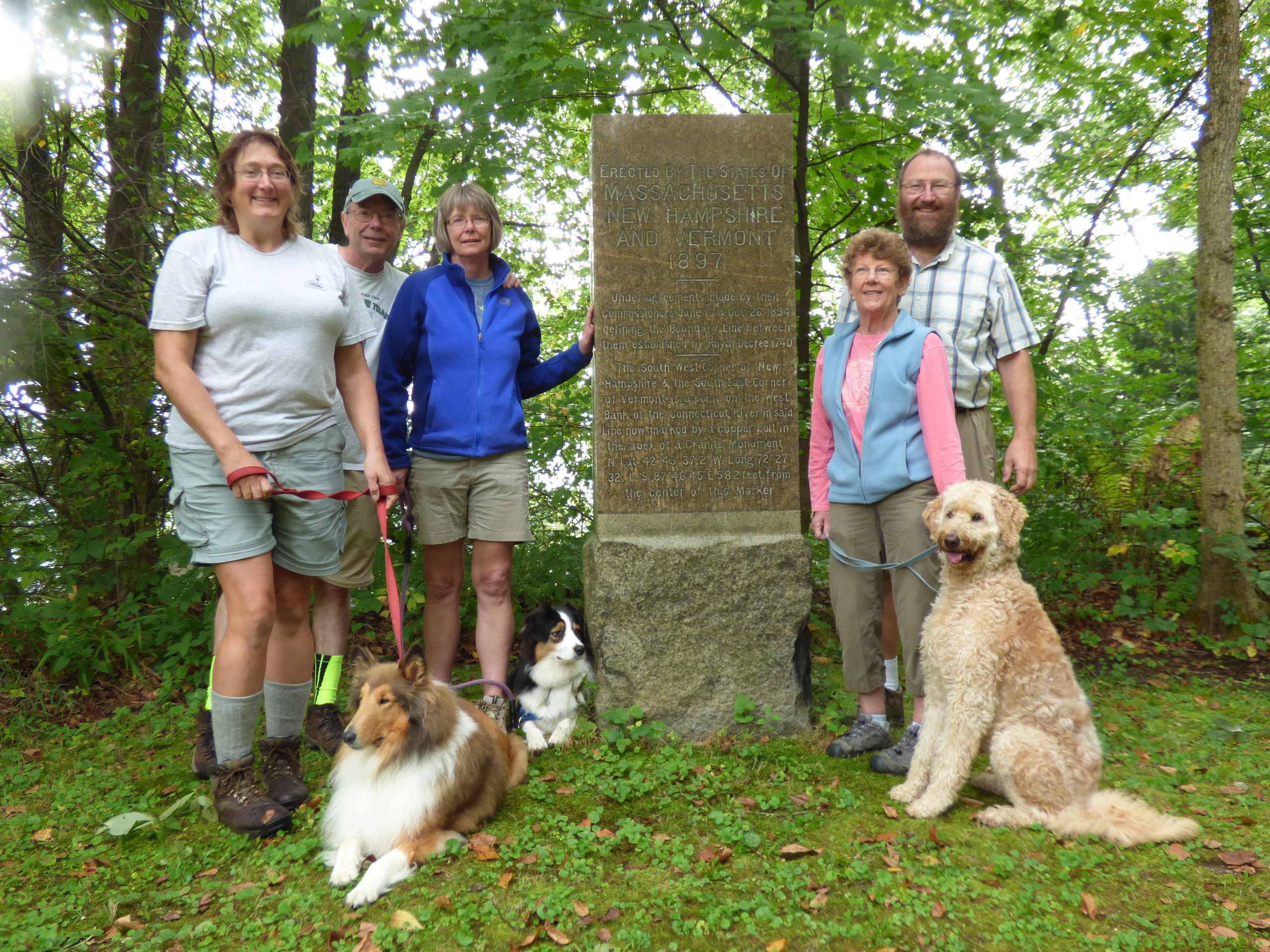
ACCESS ROUTE: This is a difficult location to reach. Park and National Forest Service Rangers and particularly Professional Surveyor Paul Scherbel and Forest Service Surveyor Jon Leonard, provided helpful information on the terrain and accessibility of this tri-point. Mr. Scherbel spearheaded a successful effort to accurately locate and restore all eight Wyoming corners. This includes six tri-State corners plus the NW and SW corners which are not tri-points. Scherbel and Leonard were at the ID-MT-WY tripoint on August 20, 1995 with a group of about 30 people. They had a difficult time finding the comer marker, but after locating it, they erected a rock cairn beside the marker post and put yellow metal Bearing Tree signs on a circle of trees around the corner. They also set up a 12-channel Trimble Pro XL GPS receiver and collected data which was differentially corrected using input from base stations in Butte, MT and Jackson, WY, to obtain geographic coordinates estimated to be accurate to one meter. As reported by Jerry Messick, these coordinates, based on NAD83 Map Datum, are N 44° 28' 32.27", W 111° 03' 08.62". Elevation at the tri-point is approximately 8330 feet.
The 1874 survey of the ID- WY meridian boundary set a marker post at the assumed crest of the Continental Divide. A 1906 survey found the 1874 mark 6 miles too far north and replaced it with the marker at the present location.
This area was in the North Fork fire area, one of many parts of Yellowstone Park and the surrounding National Forest which burned in the devastating fires during the summer of 1988. The North Fork fire was very intense and destroyed the soil, so there are large areas with little regeneration yet, except for scattered patches of wild flowers, grasses along the stream, a few new trees and occasional trees which survived the fires. Travel is very difficult because of the large number of downed, partially burned trees criss-crossed on the ground.
From West Yellowstone, go W and S on US20 to Island Park Ranger Station. Check with the rangers for changes in the route and location of gates on the access road. Because of many road closures, the only possible route is via Forest Road 066. From Macks Inn on US 20, 6 miles N of the Ranger Station, go E 4.8 miles to Big Springs. At 0.9 mile beyond the Big Springs bridge turn R on FR 066. Proceed on 066 for 12 miles to a locked gate. Park and continue on foot for 3.8 miles to where the road crosses Thirsty Creek on a sharp bend in the road. At this point the coordinates are N 44° 28.3', W 111o 06.0' at elevation about 7860 feet. Note that closure of another gate 2.5 miles farther NW may be implemented later in 1997, thus involving a hike of 6.3 miles to the Thirsty Creek crossing. Bicycles are allowed but no motorized vehicles.
The route Clark Hall and I took from 066 was up Thirsty Creek on its N side to the fourth drainage coming in on that side. Normally Thirsty is dry by mid-summer, but in 1997 it had a lot of water in it. However, all the side drainages were dry. Hike up the fourth drainage to the plateau above. Then proceed at approx. 80° true to the marker. While this may be done by compass, it is much easier with a GPS navigation unit. Just be sure you know how to use your GPS and have extra batteries so your unit won't go dead before you get back out to the road. Distance from 066 to the tri-point according to the GPS (straight line) is 2.37 miles, but actual hiking distance is probably closer to 4 miles. No permit is needed for day trips but is required for overnight camping in the National Park. Take plenty of water since above Thirsty Creek there is little water.
Update - July, 2003 - Jack Parsell
The Northern access on route 066 is closed at the first gate now, making it 8.6 miles from there to the Thirsty Creek Bridge. Bob Whitney and Penn Watson accessed 066 from the South now that that section of the road is open. Contact Bob for route details.
Update - ??? - Brian J Butler
You can view the update at The Corner Corner.
Update - Summer, 2006 - Bob Whitney
The most important tip is to use the Messick coordinates provided in Jack's text which, after converting seconds to fractious of minutes, are N 44/23.538 and W 111/03.144. On our first trip we ignored these coordinates and couldn't locate the tripoint. On our second trip our GPS's led us to within 10 feet of the tripoint cairn and told us that the Merssick coordinates are 0.21 miles removed from the coordinates provided by Jack. Jack mentions the possibility of an additional gate being closed and this has occurred since his visit. We found two approaches which, now that the gate has been added, result in shorter mileages than his suggested route.
One approach involves walking to Thirsty Creek on FS 066 from the south rather from the north as Jack did. This reduces the length of the hike by about I.5 miles each way compared to Jack's route. To use this approach take the Springs Loop Rd (FS 059) east from Macks Inn. After 3.1 miles, turn right on FS 082. After 7.8 miles find a highly barricaded (against snowmobiles) road leading up a hill. This road appears as a faint line on the Caribou-Torghee National Forest travel map. After about 1.5 miles this road joins a road marked as FS 066. Follow FS 066 3.3 miles to Thirsty Creek, arriving in the opposite direction from Jack's approach. Frank and I followed Jack's suggestion of going upstream on Thirst Creek to the "fourth drainage". The coordinates for this junction are N 44/28.282 and W 111/05.133. We took slightly different routes from that junction to the marker and back relying on our GPS's for navigation.
A second approach, that Frank and I tend to prefer, is to come in from West Yellowstone. Take Iris Rd south about 14 miles~ in route 14 as shown on the Gallatin National Forest map. When the road ahead is blocked by a gate, park and walk past the gate (ignore the ungated road to the right). Walk about 2 miles on a good road. Where this road makes a very sharp turn, continue essentially straight ahead into a gully/canyon. Frank and I left this gully less than a mile after crossing into Yellowstone National Park and went in on as straight a line as possible, as directed by a GPS. With hindsight, it may be better to stay in this gully to the point where it is roughly a mile to the tripoint. Even though the gully zigs and zags, it generally has fewer fallen trees (a delayed result of the massive fire of 1988) to step over than on the ridges above. This route would take 15 or 16 miles round trip from where you park, depending on how long one stays in the gully. Frank Sangent may be interested in accompanying someone on the "extended gully" alternative.
A final comment, regardless of which approach, the fallen trees are very dense in places and can be troublesome to step over.
Trip Report - Aug 4, 2005 - Greg Weiler
Bill Wentzel has an update provided by Greg Weiler at The Trek Stop. [Ed: Because the blog images obscure some of the text, it is quoted here. See the blog post for additional photos.]
Jean & I finally bagged this one on 4Aug05. As Jack Parsell said, this is a difficult site to reach. Also, we referred to Bob Whitney's suggested route (HP Newsletter #69) and found the barricaded road, almost completely overgrown. Two miles further, we came to a gated road on the left which appeared to be the beginning of Black Canyon Loop FR066. Bob had e-mailed me input on this alternate southern route but, since we attempted this 3Pt 2 years earlier, we opted for Jack's northern approach, more familiar to us.
Past Big Springs, ID, we located FR066 and followed it 9mi to the gate. From our previous exploration, we knew to reserve bicycles in West Yellowstone where the renters tied them to the back of our also rented Chevy Malibu. At 930AM we began pedaling FR066 - not steep, but long, gradual upgrades for aprx. 6mi. - calling for a pair of hardy legs. We reached the Big Thirsty trail head at 1020AM when we went on foot and headed toward the "4th drainage ditch."
For 90min we had to continually skirt around dead trees. Once in the ditch, even more of these obstacles blocked our path. After an hour we decided to climb out and just straight line it to the TP using the GPS. More dead, burned trees were encountered for the next 1 1/2hr until, at 145PM, we spotted the yellow bearing tree signs and, just beyond, the cairn TP post. The GPS had led us directly to it! The day ended at 830PM when we reached our motel and went horizontal. Ahhhh....
Note: This Yellowstone NP area is very isolated and desolate with standing and fallen burned trees that offer no reference. Be prepared for a min. 6-8hr hike (gwhiker@ix.netcom.com).
ACCESS ROUTE: From Kemmerer, WY take US 30 West for 24 miles, then N 20 miles to Cokeville. At Cokeville, go W over the RR, and over Bear River. Continue S on county road #231 for 7.4 miles to Christy Canyon road on the right. This is marked by an arrow shaped sign inscribed, MONUMENT 4 MILES. Go up this road to a gate at the WY- UT line at 3.2 miles (be sure to close the gate after passing). This is a rough road, barely passable for 2WD vehicle in good weather. Do not attempt it in bad weather. At 0.2 mile into UT another arrow directs you to the right, up a side canyon, for l/3 mile, then the final arrow points to the right, up the steep hillside 0.1 mile to the monument.
When we were there in 1991 the marker had been knocked down by cattle. Paul Scherbel, Land Surveyor from Big Piney, WY, had found this same situation in 1990 and was instrumental in leading a field investigation project in July, 1991. New monuments were placed in July, 1992, with a sturdy fence around them, and a dedication ceremony was held on August 28, 1992. The plaque mounted beside the new monument reads as follows:
IDAHO, UTAH AND WYOMING INTERSECT POINT
THIS STONE MARKS THE INTERSECT POINT ESTABLISHED JUNE 15, 1874, BY A.V.RICHARDS, U.S. ASTRONOMER AND SURVEYOR, ON THE 34TH MERIDIAN WEST FROM THE CENTER OF THE OLD NAVAL OBSERVATORY DOME IN WASHINGTON, D.C. WITH THE STATE BOUNDARY OF IDAHO AND UTAH < THE 42ND PARALLEL NORTH >, SURVEYED BY DANIEL G. MAJOR, U.S. ASTRONOMER, ON AUGUST 29,1871.
THE INITIAL POINT MONUMENT OF D. G. MAJOR FOR THE 42ND PARALLEL NORTH IS LOCATED 7/10 OF A MILE EAST.
CONTRIBUTIONS FOR THIS REMONUMENTATION WERE OBTAINED FROM THE FEDERAL GOVERNMENT, STATES, COUNTIES AND THE PRIVATE SECTOR.
Update - Summer, 2006 - Bob Whitney
This tripoint probably does not need a 4WD except in very wet weather. Most people will find it convenient to do #6 and #7 tri-points on the same trip and 4WD might then be used for both.
ACCESS ROUTE: From I-80 in Rock Springs, WY go S on US 191 about 41 miles to CR62. Turn L on CR62, an excellent gravel road and proceed, crossing a concrete bridge at 5.6 mi. and the WY-UT line at 6.8 mi. At 7.5 mi. turn R and follow signs to Browns Park. At 12.8 mi. turn L at sign reading: "3 CORNERS 10 MI." After 5.6 mi. on this fair to good road, bear R at a backed-up sign at top of a hill that reads: "TRI STATE MARKER 4." Continue on this fair to good road to the marker which at 8402 ft. makes this the highest tri-point. This is a very scenic area so go early enough in the day to allow for lingering at the tri-point and along the access roads to enjoy the scenery. These roads are passable for 2WD drive vehicles, but if it is extremely wet or wintry, a 4WD is advisable, especially for the last 10 miles. There is a large billboard-like sign at the tri-point with the following text:
PUBLIC LAND SURVEY MONUMENT Tri State Corner of the States of Wyoming, Utah and Colorado (Lat. 41° 00' 42.616" N Long. 109° 02' 42.158" Elevation 8402')
This point was monumented by surveyor Rolin J. Reeves on July 19, 1879, while completing the survey of the west boundary of the state of Colorado and the east boundary of Utah Territory. The boundary line separating Wyoming Territory from Colorado and Utah Territories was surveyed by US surveyor A V. Richards in 1873.
The original monument was found to be disturbed in 1931, and was remarked by US Cadastral Engineer E. V. Kimmel with a brass tablet seated in a concrete monument.
This monument is one of the comers of the National Rectangular Cadastral Survey System inaugurated in 1785, that has aided the development and orderly settlement of the public lands of the western states. From these monuments, State and Local Governments and private citizens are provided with easily identifiable boundaries. Such monuments serve as a base for the work of private surveyors in making accurate land sub-divisions and descriptions.
Erected by the Kiwanis clubs of Rock Springs, WY, and Craig, CO and the Lions club of Daggett County, UT in cooperation with the Bureau of Land Management, and dedicated on August 21, 1966. Embedded in the concrete base of this monument are some of the original stones which marked the location in 1879.
Update - Summer, 2006 - Bob Whitney
The approach roads have deteriorated to the point that we recommend a 4WD in all weather. Most people will find it convenient to do #6 and #7 tri-points on the same trip and 4WD might then be used for both.
The quadri-point is located at the "Four Corners Monument" which is administered by the Navajo Nation.
Bill Wentzel has a blog post at The Trek Stop with links to articles detailing how the true quadri-point is off by as much as 2.5 miles from where it is currently located. You can also read his 2006 trip report.
Trip Report - Oct, 1988 - Jack Parsell
ACCESS ROUTE: This is Four Corners, the only spot where four States come together. It can be considered as four tri-State comers at one location. However, it is the same spot in each case, so it is simpler to count it only once.
Four Corners is located on the Navajo Indian Reservation less than 1/2 mile off US 160. A fee is charged to enter the property. The Four Corners point was established by C. Robbins as the closure of the CO - NM line in 1875. A new stone was set in 1899. In 1931 Everett H. Kimmell, General Land Office Surveyor, replaced the stone with the concrete monument now there. In 1962 a 28 foot square ornamental concrete slab was placed around the monument.
ACCESS ROUTE: From Buffalo, SD go W 24 miles to Camp Crook, SD. Then go 28 miles N, on a good dirt road, to the ND line, where a double span iron bridge crosses Boxelder Creek. Continue 1/2 mile beyond the bridge, up on the bench above the creek, where a faint farm road goes left into the pasture. Follow the farm road, along the edge of the bench, and along the edge of fields, heading generally W, for about 2 1/2 miles. The last 1/2 mile is along the ND-SD fence, in ND, to boundary marker #359. Park and hike due W, past marker #360, to the red granite tri-State marker post, dated 1892, about 1.6 miles from marker #359.
The boundary line between ND and SD which is the seventh standard parallel north, of the public land survey, was surveyed in 1891-92 from the Bois de Sioux River (see also MN-ND-SD) to the MT line. Snyder Hill, in Montana, is a prominent landmark WSW about 1/4 mile and 150 feet higher than the tri-point.
Update - July, 2003 - Jack Parsell
Somebody told me the faint farm road is either too hard to follow or impossible so you have to hike all the way in from the road, north of the bridge over Boxelder Creek.
Update - Summer, 2006 - Bob Whitney
We could not find the "faint farm road" noted by Jack and locals say it is no longer advisable to use. One approach is to walk in along the river under the iron bridge and then follow a fence on the ND/SD line. One may also go north from the iron bridge slightly over one mile to the Cox Ranch Road. Take this road west to the ND/MT line. Delorme CD's and gazetteer show a road going in a southerly direction which stars close to that line and takes one to about 1/2 mile from the tripoint. We did not check whether that road is drivable. If that road is not drivable, walking down the ND/MT fence line would involve a longer trip than previously mentioned.
There is a way to drive all the way to the tripoint. We were graciously assisted by locals in the following somewhat complicated drive in. Permission from the Burdicks should be obtained by calling 406-775-6380 or stopping at their ranch (location noted below). Take the Cox Ranch road described above about 7 to 9 miles to a T junction. Go left for 5.1 miles. Turn left at the Burdick mailbox. Their ranch is on the right shortly before one needs to turn left after 1.8 miles. Go 1.5 miles crossing a creek en route and the road then turns right. Go 0.4 miles to find a good farm road on the left, which is not easy to detect from the main road. If you come to a pond with an earthen dam, you have gone too far. Take the farm road 0.8 miles directly to the tripoint. One may also get to the T junction with Cox Ranch Rd. from Baker, MT by consulting a Montana gazetteer. Interestingly the roads through the Burdick ranch are shown in the gazetteer, except for the last 1.2 miles.
Update - July, 2007 - Greg Weiler Coordinates: N45d 56.716m, W104d 02.733m, elev. 3048 ft Date Visited: June 25, 1991; Revised July 2007 Access Route: From Buffalo, SD go W 24 miles to Camp Crook, SD. Then go 28 miles N, the first 16 miles paved, the remainder hard packed gravel, to the ND line where a double span iron bridge crosses Boxelder Creek. Continue about 1.5 miles beyond the bridge to a left (W) onto unsigned Cox Ranch Road. Follow this hard packed gravel road, past a facility with a small microwave tower at 1/2 mile, about 3 miles to the MT-ND line where the road becomes loose packed gravel. Continue another 4 miles to a T-intersection. Turn left (S) and go 5.1 miles to the Burdick mailbox on the left. Turn left (E) and go 1.8 miles on a gravel road to the Burdick ranch on the right. Get permission to cross their property (if you haven't done so already by calling them at 406-775-6380).
Follow the dirt road past the turnoff for the ranch for 1.5 miles crossing an unbridged shallow creek en route. The road turns right (E) with a fence line on the left. Go 0.4 miles to a gate in the fence line and proceed N through the gate for the final 0.8 mile along the MT-SD fence line on the right to the tri-point, passing MT-SD marker 203M/65 on the way.
The ND-SD boundary line which is the 7th standard parallel north, of the public land survey, was surveyed in 1891-92 from the Boise de Sioux River (survey details MN-ND-SD), to the MT line. An inscription on the monument reads "1892 T.M. 360M 45.35 C" (Territorial Monument, 360 Miles, 45.35 Chains). Snyder Hill, in MT, is a prominent landmark WSW about 1/4 mile and 150 ft higher than the tripoint.
Update - March, 2017 - Frank Sutman
[more detailed driving directions]: From Buffalo, SD at the intersection of US 85, go W 24 miles on Rt. 20 to Camp Crook, SD. Then go 28 miles N, on Rt. 867, a good dirt road, to the ND line, where a double span iron bridge crosses Boxelder Creek. [Ed: continue with Jack's description].
ACCESS ROUTE: From Belle Fourche, SD at the intersection of US 212 and US 85, go N on US 85, 11.9 miles to a turn-off L, which is around the first bend in US 85, and across Owl Creek. Then go NW about 15 miles to where the road turns due N. Continue 1 3/4 miles N and then about 0.4 mile NW to a gate on the left, just before reaching the MT - SD line. The tri-State monument is 0.5 mile W of this gate.
Note that the NE corner of WY and the SE comer of MT do not coincide. The 27th meridian survey from the south brought the line up 23.3 seconds too far west. The survey south from the Canadian border brought the line 41.6 seconds too far east at the same latitude. The combined error is 70.68 chains or about 0.88 mile. The original 1877 marker was replaced in 1904 by a stone post. When we were there the post was found to be tipped over. This was subsequently repaired, and a joint dedication ceremony was held on July 16, 1994 for the tri-point and also for the monument at the Southeast corner of Montana.
The dedication ceremony highlights included: history of the Dakota - Wyoming boundary survey; history of the Dakota - Montana boundary survey; signing of the field notes and plat; history of settlement in the area; and the importance of boundary identification and land tenure system.
Update - Summer, 2006 - Bob Whitney
The walk-in gate and road mentioned by Jack are a little difficult to see from the road. It is slightly easier to park by the County Line sign at the MT/SD line, open the gate there and walk along the MT/SD fence line.
Update - July, 2007 - Greg Weiler Coordinates: N44d 59.857m, W104d 03.462m, elev. 3422 ft
Date Visited: June 24, 1991; Revised July 2007 Access Route: From Belle Fourche, SD at the intersection of us 212 and US 85, go N on US 85 11.9 miles to gravel Camp Crook Road on the L, which is around the first bend in US 85 and across Owl Creek. After 2.5 miles turn left (W) onto gravel Albion Road. Continue NW about 13 miles to where the road turns due N. Continue albout 1.8 miles N and then about 0.4 miles NW to a gate on the left just before reaching the MT-SD line at a fence line. Park across from the county line sign and hike along the fence line 0.5 miles W to the tri-state monument.
There are 3 reference marks flush with the ground at 19.8 ft (6m} from the monument, one in each state. Note that the NE comer of WY and the SE comer of MT do not coincide. The 27th meridian survey from the S brought the line up 23.3 sec too far W. The survey S from the Canadian border brought the line 41.6 sec too far E at the same latitude. The combined error is 70.68 chains or 0.8835 miles. The original 1877 marker was replaced by a stone post in 1904. At the 1991 visit the post was found to be tipped over. It was subsequently repaired and a joint dedication ceremony was held July 16, 1994 for the tri-point and also for the monument at the SE comer of MT.
Newsletter - #107-14q4-p38 - Jim Wright
In Jack Parsell's instructions, he states to turn L off US-85 "around the first bend" north of Belle Fourche. My GPS unit called the road "Camp Crook Road" but there weren't any street signs at the intersection. Drive north 2.5 miles on Camp Crook Road then turn left onto Albion Road (marked) and drive 14.1 miles to the Montana state line. At the state line, there is a small parking area to the left. In dry weather, you could probably drive back to the tripoint, but it's an easy third of a mile hike along a fence from the parking area. The tripoint is surrounded by fence to protect it from cattle and the gate into the tripoint is on the South Dakota side of the fence, so I had to climb the fence to get to the tripoint.
ACCESS ROUTE: From Harrison, Nebraska, go N on Route 29 about 10 miles to the Coffee ranch. Turn L under the ranch sign, cross a creek, and continue W and N past the Schnurr ranch. At about 12 miles beyond the Coffee ranch, the road crosses into WY. The first turn off right in WY is to the Tollman ranch. Take the second turn off to the right, about 1 1/2 miles W of the WY - NE line. Follow this road N and E with several bends in the road. The road finally turns due N very close to the WY - NE line. Continue about 1 mile, then the road bends left, crosses Indian Creek and goes up to the Jordan ranch.
Visitors should stop at the ranch house and get permission and directions for proceeding the remaining mile across the fields to the tri-state point. The low white limestone Chaffee monument is next to the taller quartzite Jenkins monument. A bronze plaque (see text below) is mounted near the monuments.
THE COMMON CORNER TO NEBRASKA AND SOUTH DAKOTA ON WYOMING LINE
The Survey for the boundary between Nebraska and Wyoming territory began August 17th 1869 at the intersection of the 41st Parallel of Latitude and the 27th degree of Longitude W of Washington, DC. Oliver N. Chaffee, Astronomer and Surveyor and his crew surveyed North on the 27th Meridian 138 miles, 22 chains and 67 links, and set a white limestone monument here on September 6th 1869.
In 1874, beginning at the Keya Paha River and ending at the Chaffee monument, Chauncey Wiltse surveyed the 43rd Parallel of Latitude between Nebraska and Dakota Territory.
In 1893, Joseph Jenkins retraced the Wiltse Survey and set a quartzite monument here and at 1/2 mile intervals from the Chaffee monument to the Missouri River.
In 1908, Edward F. Stahle retraced the Wyoming-Nebraska boundary and set granite posts at mile internals and brass caps at closing corners.
In recognition of those early Surveyors, the skills they demonstrated and the hardships they endured, we dedicate this Plaque on September 6, 1989.
The geographic position of the Chaffee monument is based on NAD1983 and determined by the Global Positioning System. Latitude N 43000'02.251", Longitude W 104003'11.315", Elevation 1198.4 Meters (3931.70 feet).
Update - July, 2003 - Jack Parsell
Note that Dan Jordon is no longer living, but the family still owns and operates the ranch.
Update - Summer, 2006 - Bob Whitney
The Jordans are gracious but spend most of their time in Lusk, WY. They still would like anyone going to their ranch to call at 307-334-2520 to let them know your plans. There is a fence along the WY/NE line but don't head for it as soon as you get to the ranch or you will have to climb a very steep and slippery slope. Instead head north keeping a farm building on your right. After gaining some elevation you will see that it is OK to angle towards the fence line.
Update - July, 2007 - Greg Weiler Coordinates: N43d 00.037m, W104d 03.189m, elev. 3932 ft Date Visited: June 24, 1991; Revised July 2007 Access Route: From Harrison, NE where Rt 29 goes S turn N onto paved Monroe Canyon Road. In about 8 miles the pavement ends and becomes hard packed gravel. At 10 miles turn left (W) at the Coffee Ranch sign onto Schnurr Road. Continue past the Harris Schnurr Ranch in another 4.5 miles. 2.5 miles further on make a right at a Y at the Schnurr Ranch 96 sign. In another 5 miles cross into Nabraro County, WY. Note that the fence line here to the right (N) intercepts the tri-point about 5 miles away. The 1st turnoff to the right (N) in WY leads to the Tollman Ranch. Take the 2nd turnoff to the right at the Luker and Jordan ranches sign indicating 5 miles to the Jordan Ranch. Follow this hard packed dirt road past the Luker Ranch at I.5 miles. The road finally turns due N very close to the WY-NE fence line. About a mile later the road bends left, crosses a creek (sometimes dry) and goes up to the Jordan Ranch house.
The Jordans spend most of their time in Lusk, WY so be sure to call ahead {307-334-2520) for permission to cross their property. From the house the tri-point is 1.2 miles NE. Hike up the hill to the right behind the barn, past old discarded farm machinery to a gate in the fence line. From here the tri-point is 0.8 miles away. Pass through the gate, angle right toward the WY-NE fence line and follow the fence N to the fenced-in tri-point monuments, passing through another gate in a fence line and Stahle post 138M along the way.
At the tri-point the low white limestone Chaffee monument is next to the taller quartzite Jenkins monument. A bronze plaque (see text above) is mounted near the monuments. Be sure to sign the visitor register.
Newsletter - #107-14q4-p38 - Jim Wright
There isn't anything to add to Jack's description of how to get to this tripoint other than the road itself. Parts of the 15 mile road are gravel, but several parts are simply dirt with tall weeds growing in the middle of the road. My small car made it because the roads were dry, but I frequently had to straddle deep tire-ruts in the road and I could hear the weeds hitting my bumper and rubbing along the bottom of the car. A truck of SUV would be preferable, especially if the road is wet. The tripoint is on private property call the Jordan Ranch, currently leased by a pleasant gentleman named Trevor. Trevor took me to the tripoint in his truck to save me the hike.
Introduction - City of Kimball
The City of Kimball provides a brief history of the tri-point here.
Trip Report - July 9, 1991 - Jack Parsell
ACCESS ROUTE: Leave Interstate 80 at exit #401 at Pine Bluffs, WY. Go N to 8th Street, then E on 8th Street for 0.6 mile to Beech Street. Go S on Beech 12 miles to the CO line. Turn E and drive 3/4 mile on a pasture road along the WY - CO border past a wind mill to the tri-State marker.
The Nebraska high point, Panorama Point, at elevation 5424 feet, is 1.3 miles ENE of the tri-point.
A ceremony was held on August 16, 1997 to dedicate the restored corner marker. The information given concerning the monument is as follows:
CORNER COMMON TO NEBRASKA AND WYOMING ON THE COLORADO STATE BOUNDARY
Oliver N. Chaffee, U.S. Astronomer and Surveyor, established this corner monument August 17, 1869 at the intersection of the forty-first parallel of north latitude with the twenty-seventh degree of west longitude (west of Washington, D.C.). Mr. Chaffee continued the survey northerly to a termination point on the forty-third parallel, marking the first boundary survey of Wyoming Territory.
Art Henrickson and Howard Kieler rehabilitated the monument in 1981. A brass disk was drilled into the top center of this comer stone in 1990. Federal, State and Local organizations coordinated additional preservation in 1997.
Update - July, 2003 - Jack Parsell
Additional repairs and a protective fence are changes at this point. I don't know whether the three different colors are still used.
Update - June, 2004 - Bob Whitney
When Frank and I visited this tripoint in June 2004, it coincidentally was the day the attractive comer marker was being repaired from an act of vandalism. It was interesting to lean of the local interest in financing this project and making the monument more vandal proof.
Update - Sept, 2015 - Frank Sutman
[more detailed driving directions]: Leave Interstate 80 at exit #401 at Pine Bluffs, WY. Go N to 8th Street, then E on 8th Street for 0.6 mile to Beech Street. Go S on Beech 12 miles to the CO line. Turn E through a gate and drive 3/4 mile on a pasture road along the WY - CO border past a wind mill to the tri-State marker. In wet weather you may want to park prior to the windmill and walk the remaining 1/4 mile.
The Nebraska high point, Panorama Point, at elevation 5424 feet, is 1.3 miles ENE of the tri-point. Do not hike between the tri-point and the high point, as it is open bison range. Drive around (from the tri-point W, S, E. N, and finally W again) on farm roads.
Introduction - St Francis Area Chamber of Commerce
This tri-point (1 of 4 Kansas tri-points) is located near St Francis, Kansas. The chamber of commerce describes this northwestern "Three Corners" tri-point and how to access it from the Kansas side here.
Trip Report - June 23, 1991 - Jack Parsell
ACCESS ROUTE: Our 1991 route to this point is difficult to follow. Here is an easier route sent to me by Timothy Sheehan of Farmington, CT. From US 34 about 1.5 miles W of the CO-NE line, tum S on "County Road RR" which is 100 yards E of mile marker #254 on US 34. Go S about 4 miles, then E and SE about 1 3/4 miles to a left turn into a farm lane which goes in to the tri-point. There is a sign where the farm lane turns off from the road.
The mail box at the site contained information leaflets. The bronze plaque displays the following information:
THE CORNER COMMON TO NEBRASKA AND KANSAS ON THE COLORADO LINE
The survey of the base line of the 6th principal meridian, which also marks the boundary between Nebraska and Kansas, was extended from the Alma, Nebraska area to the summit of the Rocky Mountains by Jarret Todd and James Withrow in 1859.
In 1869 Oliver N. Caffee [sic] surveyed the western boundary of Nebraska, and failing to locate the baseline, set the limestone monument 621.7 feet South of this position.
In 1872 John J. Majors surveyed the boundary between Kansas and Colorado, commencing at Chaffee's monument.
On June 15, 1873 Edwin Burwell intersected the baseline with Chaffee's state line and established the corner of Nebraska and Kansas on the Colorado line.
On October 17, 1990 the Bureau of Land Management re-monumented this tri-state corner.
In recognition of those early Surveyors, the skills they demonstrated and the hardships they endured, we dedicate this Plaque on June 1, 1991.
Trip Report - Sept 18, 2008 - Bill Wentzel
You can view the trip report at "The Trek Stop". It contains new driving directions.
Trip Report - Oct 28, 1995 - Jack Parsell
ACCESS ROUTE: From the Kenton, OK post office, go E on County Road 325 for 0.6 mile. Turn Left (N) on a county road, crossing the Cimarron River, and then following a tributary stream to the CO line, about 8.7 miles from route 325. At the Baca County, Colorado line turn L and proceed about 1 mile on a good dirt road which follows close to the OK- CO line and leads to the tri-State marker. A much older survey post is about 200 yards N over a knoll from the new marker. As with many of the tri-points, this one has been resurveyed and relocated several times. The present marker was installed in 1928 and confirmed in 1968, but recent satellite mapping shows it to be off by 4 feet.
The route to this tri-point from Kenton, OK, passes the Nature Conservancy parking lot, which is the access point for climbing to the Oklahoma high point, 4973 feet elevation on top of Black Mesa.
Trip Report - Oct 14, 2007 - Roger Simpson
You can view the trip report at "Simpson Family OK trip".
Update - Oct, 2015 - Frank Sutman
Just N of Kenton you will pass the High Point Bed & Breakfast. Further N on the road, there is trailhead parking and a trail that leads to fossilized dinosaur tracks.
Trip Report - Nov 20, 1990 - Jack Parsell
ACCESS ROUTE: From US 56 at the NM - OK line go S on a boundary-line road 1.5 miles to a tee in the road at the TX border. The Tri-State marker is in the field just S of the tee in the road.
Note the jog in the TX - NM boundary at the NW corner of TX. John H. Clark surveyed the W boundary of Texas on the 103rd meridian up to N 36° 30' latitude in 1859. Later it was found that Clark's corner was a little over 2 miles W of the true 103rd meridian, which became the W boundary of the OK Public Land Strip. In 1911 a joint congressional resolution declared the line as marked by Clark to be the true boundary between Texas and New Mexico. The original Clark's Monument at the edge of route US 56 is no longer there due to a road widening project.
Update - Sept 1, 2008 - Bill Wentzel
From Rt56/64/412, at the NM/OK line, go south on Feeder Road 1 mile to a T-intersection. The marker is immediately behind the wire fence. See guide for description of other historic markers in this area.
Update - Oct, 2015 - Frank Sutman
Note that the marker is quite small and not visible from the road right of way.
ACCESS ROUTE: From the junction of routes 95 and 56 near Elkhart, KS go N on 95 for 0.1 mile, then turn L (west) onto signed Road A. Proceed W on this road which becomes a good dirt road and after 7.7 miles reach the tri-point. The marker is a large, round metal plate set in the middle of the road in 1990. There is also a windmill marker in a small fenced-in park on the N side of the road.
On Jan. 29, 1861, when Kansas was admitted to the Union, the 25th meridian W of Washington, DC was established as the W boundary of KS. Colorado was organized as a territory on Feb. 28, 1861 with the same boundaries as at present, being made up from parts of the Territories of UT, NM, KS and NE. Earlier in 1858 a concerted attempt had been made to organize the "State of Jefferson" in this area, but by popular vote in 1859 it was decided to organize a Territorial government instead. The S boundary on the 37th parallel had been established by the Macomb survey of 1858-59. The CO - OK portion of the 37th parallel was resurveyed by John G. Major in 1873-74. Dates on the tri-point marker are the years each of the states was admitted to the union.
Trip Report - June 15, 2009 - Roger Simpson
You can view the trip report at "Simpson Family OK trip".
ACCESS ROUTE: The original survey of the ND - SD boundary line was on the 7th standard parallel north, and was surveyed in 1891-92. The first marker was placed 9 chains W of the Bois de Sioux River bed. The U.S. Corp of Engineers changed the channel of the river leaving MN land on the W side of the river at the ND - SD line, so the tri-point is not in the middle of the river.
From Interstate 29 in SD, use exit 246 and go E and then N on route 127 to White Rock Road, which is 1 mile S of the ND - SD line. Lakeview Cemetery is at the NE corner of this intersection. Go E for 2 miles on the White Rock Road, then 1 mile N to the ND state line. Turn E and go a little over 1/2 mile on a farm lane to the ND - SD stone marker #1. There is a drainage ditch along the right (S) side of this road. The tri-point should be between the ND - SD marker and the river but no monument or marker could be found in that area. The Boise de Sioux River is a little over 0.1 mile E of the ND - SD marker.
If approaching from the N, take route 127 S from Wahpeton, ND to the White Rock Road corner described above. Note that the hamlet of White Rock, although it shows on most maps, is a ghost town with a population of 2 in 1993.
Update - July 26, 2001 - Brian J Butler
You can view the trip report at The Corner Corner.
Update - July, 2007 - Greg Weiler Coordinates: N45d 56.115m, W96d 33.804m, elev. 970 ft Date Visited: August 25, 1993; Revised July 2007 Access Route: The original survey of the ND-SD boundary line was on the 7th standard parallel north, and was surveyed in 1891 -92. The first marker (Initial Monument, inscribed IN. MT.) was placed 9 chains (594') W of the Boise de Sioux River riverbed. The U.S. Corps of Engineers changed the channel of the river leaving MN land on the W side of the river at the ND-SD line, so the tri-point is not in the middle of the river.
From I-29 in SD take exit 246 and go E 11-1/2 miles then N 4 miles en Route 127 to 101 ST which is 1 mile S of the ND-SD line. Lakeview Cemetery is at the NE comer of this intersection. Go E on 101 ST for 2 miles then left (N) on an unmarked gravel road for 1 mile to the ND-SD state line at the intersection of 183RD AVE SE and 102ND ST SE. Turn right (E) and go about 1/2 mile to the end of a farm lane to the ND-SD Initial Monument.
The Initial Point as inscribed on the monument is 9 chains east (IN. PT. 9 C.E.). There is a drainage ditch along the right (S) side of this lane. The tri-point should be between the ND-SD Initial Monument and the river but no monument or marker could be found in the area. The Boise de Sioux fiver is a little over 0.1 mile E of the Initial Monument.
Newsletter - #107-14q4-p38 - Jim Wright
In Jack Parsell's description of this tripoint, he states to take exit 246 and go east on route 127. That road is locally marked as 105th street. 127/105th street curves north then you turn east onto 101st St (Jack calls it White Rock Road) at the Lakeview Cemetery. Turn north onto an unmarked gravel road (my GPS called in 480th Street) and travel one mile to the ND-SD state line. Jack then states to travel east on a farm lane to the marker. That farm lane is locally marked as 102nd Street but "farm lane" is a better description as it is unpaved and has tall weeds growing in the lane. The red tripoint marker is clearly visible at the end of the lane.
Newsletter - #109-15q2-p28 - Carol Radford Coordinates: N 4556061.93; W 963348.21
This tri-corner is the second closest to the convention site. It is approximately 225 miles northwest of Worthington and is more in keeping with the "middle of nowhere category." Take your GPS. As of 2011 there was no marker. We drove along the farm lane as far as we dared then walked up to the Boise de Sioux River (not much of a river). However, in October this was not a "white shoe" friendly place - kind of a mud slog.
Directions (adapted from Parsell's book): From Worthington go west on I-90 to I-29 in SD. Go N on I-29 to exit 246, about 160 miles. Go east about 12 miles and then N on route 127 to White Rock Rd. Go E 2 miles on White Rock Rd, then 1 mile N to the ND state line. (If you cross the RR tracks on White Rock Rd. you went too far.) At the state line turn E, go a little over 1/2 mile on a farm lane to the ND-SD stone marker. There is a drainage ditch along the right side of this road. Park where the lane stops and walk along the left side of the drainage ditch toward the river. Unmarked, the tri-point is somewhere between the ND-SD marker and the Boise de Sioux River.
ACCESS ROUTE: From Interstate 29 in SD, take US 18 East about 20 miles to Inwood, lA. Then go N out of Inwood to Larchwood on route 182, which joins route 9 before reaching Larchwood. Coming into Larchwood, leave route 9 and continue straight N about 3 miles on Rt. K 16 to the MN line. Turn left (W) on a boundary line road and proceed about mile to the tri-point in the middle of the road at a tee intersection. There is a brass pin in the middle of the road, and a plaque on a monument in SD beside the road.
The inscription on the plaque reads, "TRI-STATE MARKER 1859 SET AT THE JUNCTION OF THE STATES OF MINNESOTA, IOWA AND DAKOTA TERRITORY BY FEDERAL LAND OFFICE SURVEY OF MINNESOTA'S WESTERN BOUNDARY". The plaque goes on to report that after being damaged by vandalism in the early 1900's, it was restored in 1938. Then, after damage by vehicular traffic in 1979, it was restored at its present site in 1981.
Update - July 26, 2001 - Brian J Butler
You can view the trip report at The Corner Corner.
Update - July, 2003 - Jack Parsell
This is now a 4-way intersection. See "Apex to Zenith" Issue #73 Second Quarter 2006, p23 for latest info on this corner.
Update - Summer, 2006 - Bob Whitney
The "tee intersection" is now a 4 way intersection with 10th Avenue going N-S and llth Street going E-W. My GPS reading for the marker was N 43/30.024 and W 96/27.198. My GPS also noted that it was 1.06 miles to the tripoint from where K16 reaches the MN line. Slightly to the west of where K16 reaches the MN line, 20th Avenue goes north to a junction with I 90. Depending on where one is coming from and/or going to, this may be a good route to take. 20th Avenue as it proceeds north is also called Rock County # 12 or # 17 (couldn't decipher my handwriting).
Update - July, 2007 - Greg Weiler Coordinates: N43d 30.025m, W96d 27.197m, elev. 1411 ft Date Visited: July 10, 1991; Revised July 2007 Access Route: From I-90 exit 1 Jasper-Pipestone in MN go right (S) on Rock County 17 (20th AV) for 7.5 miles to a T intersection at llth ST (in MN, 100th ST in IA). Tun right (W) and go 1 mile to gravel 10th AV and the tri-point.
There is a monument on the NW comer of the T intersection in SD but the actual tri-point is a 1/2" diameter pin in the middle of the paved road. Note that the street signs on each comer are different depending on which state you are in. The inscription on the plaque on the monument reads, TRI-STATE MARKER 1859 SET AT THE JUNCTION OF THE STATES 0F MINNESOTA, IOWA AND DAKOTA TERRITORY BY FEDERAL LAND OFFICE SURVEY OF MINNESOTA'S WESTERN BOUNDARY. The plaque goes on to report that after being damaged by vandalism in the early l900's, it was restored in 1938, damaged by vehicular traffic in 1979, and restored to its present site in 1981.
In Jack's description, he states the "tripoint is in the middle of the road at a tee intersection." It's still a tee intersection, but it has led to some interesting street signs at the tripoint. The two roads have different names according to South Dakota, Minnesota, and Iowa, so each state has a street sign at the intersection. South Dakota claims the intersection as 488th Ave and 268th St. Minnesota claims it as the intersection of 10th Ave and 11th St. While Iowa declares it simply as 100th St and ignores the north/south road since it is not in Iowa. The large marker is located on the northwest corner of the intersection. The brass pin Jack described in the middle of the intersection was not located in the road, but an unreadable marker was located in the grass near the tripoint marker.
Newsletter - #109-15q2-p28 - Carol Radford Coordinates: N 433001.54; W 962716.84
Are you convention bound? Why not bag a tri-point? Iowa shares a tri-corner with South Dakota and Minnesota. This one is people and rental car friendly. No hill to climb, fence to negotiate, river to ford, nor dirt road to voilate the rental car contract. It is about 60 miles west of Worthington, MN.
The following directions have been adapted from Jack Parsell's "Tri-State Corners in the United States". From Worthington MN go W on I-90 about 30 miles to exit 12 (Highway 75). Go S on Hwy. 75 about 15 miles to state route 9. Go W on route 9 about 12 miles to Hwy. 182. Turn N and go to Larchwood on 9/182. From Larchwood, leave route 9, go straight N on route K16 for about 3 miles to the MN state line. Turn left (W) on a boundary line road and go about 3/4 mile to the Tri Point marker and monument.
Jack describes a marker in the middle of the road. When Keith and I visited this tri-corner in July 2007 we found the marker had been moved to the side of the road - see photo.
Reminder: road conditions and landmarks change over time. Getting lost or temporarily misplaced is always an option.
Trip Report - June 21, 1991 - Jack Parsell
ACCESS ROUTE: From Interstate 44 in Missouri, get off at the exit for US 166. Go NW on US 166 a little over 1/2 mile. Just before entering Kansas, turn sharp L and go S on SE 118th St., a dead-end road, on the KS - MO line, for about 0.3 mile to a large stone cairn on the KS - OK side of the road. A brass pin in the center of the broken up pavement, near the cairn is presumed to be the actual tri-point. However, the most recent report (June 2000) from this site is that the pin is missing, leaving only a large pothole at the spot where the pin was presumed to be.
The name of the Territory of Louisiana was changed in 1812 to Territory of Missouri. At that time the Territory included all of the original Louisiana Purchase except the State of Louisiana. Missouri became a State on Aug 10, 1821. The western boundary of MO was established to be the meridian that passes through the middle of the mouth of the Kansas River where it enters the Missouri River. This was surveyed in 1823, resurveyed and marked in 1844-45. The KS - OK boundary was surveyed in 1857 on the 37th parallel.
Update - June 12, 2000 - Richard L Carey
You can view the trip report at Peakbagging
Update - July 13, 2005 - Brian J Butler
You can view the trip report at The Corner Corner.
Update - Aug 30, 2008 - Bill Wentzel
You can view the trip report at The Trek Stop where he gives detailed/updated driving directions.
Update - Sept, 2014 - Frank Sutman
[notes on pin/plaque marker]: The tri-point plaque is in the center of the road. Note the bison on the property to the right as you drive towards the highpoint.
Trip Report - June 21, 1991 - Jack Parsell
ACCESS ROUTE: From South West City, MO, go S about 1 mile on Route 43 which becomes OK Route 20. The monument is on the W side of the highway just off the shoulder. When the west boundary of Missouri was surveyed in 1823, a large stone post was set to mark the SW corner of the State at a point on latitude N 36° 30'. In 1906 this position was determined to be lat. N 36° 29.267', long W 94° 37.048'. The present monument was erected by the Ozark Culture Club in 1915 with part of the old marker post embedded in it. The whole assembly was installed on a new base in 1955. It is not known whether the present monument assembly was moved to its present location to allow for widening the highway.
Update - June 12, 2000 - Richard L Carey
You can view the trip report at Peakbagging
Update - April 12, 2005 - Brian J Butler
You can view the trip report at The Corner Corner.
Update - Aug 30, 2008 - Bill Wentzel
The access info doesn't vary from the guide via secondary roads. From South West City go south on Rt 43 aprx. 1 mile. This formidable marker, across the road from the "Corner Stone Station," is hard to miss.
Trip Report - May, 2009 - Roger Simpson
You can view the trip report at "Simpson Family OK trip" [bottom of the page].
Trip Report - June 21, 1991 - Jack Parsell
ACCESS ROUTE: From Rodessa, LA, go NW on LA Route 1 for 4 1/2 miles to the Three States monument on the E side of the road. This road becomes Texas Route 77. The USGS bronze disc is mounted on the top of the 1895 monument.
The N boundary of the Territory of Orleans (now the State of Louisiana) was surveyed first in 1806 along the 33rd parallel. Portions of this line were resurveyed at various times with the most westerly six miles being resurveyed in 1895. At that time a stone post was placed on the Texas line to mark the NW comer of Louisiana.
Update - June 12, 2000 - Richard L Carey
You can view the trip report at Peakbagging
Update - July, 2003 - Jack Parsell
Roots from two trees have tipped the original monument. See "Apex to Zenith" Issue #73 Second Quarter 2006, p23 which says there is also another monument there now.
Update - Summer, 2006 - Bob Whitney
The monument pictured by Jack has been replaced by a much larger one.
ACCESS ROUTE: From Fremont, IN, go E on Route 120 to the MI line, then S on the line road for 0.8 mile. A stone monument on a knoll on the E (Michigan) side of the road is inscribed as follows: "130 FEET SOUTH IS THE POINT WHERE INDIANA, MICHIGAN, AND OHIO MEET. THIS MARKER WAS ERECTED BY THE HILLSDALE COUNTY HISTORICAL SOCIETY -- 1977 --".
Off the E side of the road, in line with the tripoint, is an old witness post with markings indicating that the corner is in the center of the road. William Harris set a wood stake at the tripoint in 1817 when he surveyed the west and north boundaries of Ohio. A brown stone replaced the stake in 1869. During a joint OH-MI resurvey of the line in 1915, the brown stone was replaced by a block of granite set in a bed of concrete buried 2.5 feet deep in the center of the road. Finally, on August 28, 1999, 30 surveyors from the three state societies dedicated a new plaque which was mounted on top of the 1915 stone. This plate is in a crypt about a foot below the road surface at the center of the road. A steel cover plate at the road surface protects the monument and allows access.
Update - June 8, 2000 - Richard L Carey
You can view the trip report at Peakbagging
Update - July 13, 2001 - Brian J Butler
You can view the trip report at The Corner Corner.
Update - July, 2003 - Jack Parsell
The road to the tri-point is COPE Road. I had it as a line road.
Update - Aug 4, 2007 - Bill Wentzel
You can view the trip report at The Trek Stop. [Ed: Because the blog images obscure some of the text, it is quoted here. See the blog post for additional photos.]
On the way to the late July '07, 20th Highpointers Konvention near Wausau, WI, we bagged this easy tri-point which called for a short detour north from the Ohio Turnpike, I-80/90. Pictured, looking north, the marker is in the lower right corner (road-center), MI in the top right, OH in the lower right, and IN to the left of road-center. All aspects of this tri-corner are as described in Jack Parsell's guide with the exception of the witness marker to the east - the top of this cement post was broken off sometime after Jack's visit in '91.
We accessed the site via Rt120 (Territorial Rd.) in MI and
traveled south on Cope Rd. .8mi where there's an obvious road surface break from gravel to blacktop at the MI/OH state line. Another big clue is the red granite marker on the left shoulder, 130ft (so inscribed) north of the state's tri-junction. The heavy metal plate in the road's center can be removed to expose the 6in deep crypt and the nifty engraved plaque within (pictured).
There may not be a tripoint closer to a source of controversy than the point where Tennessee, Alabama, and Georgia meet close to the waters of Nickajack Lake. A long-lasting drought in Georgia prompted the state's General Assembly to consider asking the Supreme Court to move the Georgia-Tennessee border to what should have been its proper location.
Unless something drastic happens in the future, those wanting to visit this tripoint will find it on a hill near State Line Cemetery. To get there, one has to travel west on Interstate 24 past the junction with Interstate 59 and find Highway 156. Follow 156 to Huckabee Lane. Once by the cemetery, there will be an opening in the trees just across from the southwest corner of the cemetery. Follow the trail in the opening, and on a small mound, you will find many rocks and flagged markers. The tripoint sits in this area.
Trip Report - May 19, 1991 - Jack Parsell
ACCESS ROUTE: From Chattanooga, TN, go W on I-24 to Route 156 (about 7 miles W of the junction of I-59 and I-24). Go about 5 miles W on Route 156, and then turn S at corner by the Macedonia Church, just before the causeway over Nickajack Reservoir. Continue S to the first right (W) after crossing Cole City Creek, then keep R across a plank bridge over a small stream. Continue W to State Line Cemetery. Park at the W end of the cemetery, and hike about 200 yards further W up a hill with about 50 feet gain in elevation. In the woods, and poison ivy, find an iron post and cement marker with TVA data on it. About 25 feet S (left), find an iron sign-post above some yellow painted rocks. The sign-post and yellow painted rocks are assumed to be the Tri-State point.
The N terminus of the AL-GA boundary is at Nickajack on the TN line and by statute at the 35th parallel. Boundaries in this area were the source of much contention and many surveys were run over the years. The NE comer of AL as now marked is more than 1 mile S of the 35th parallel, A survey in 1818 locates the comer one mile and 28 poles from the S bank of the Tennessee River and due S from the center of the old Indian Town of Nickajack, near the top of Nickajack Mountain.
Update - ??? - Brian J Butler
You can view the trip report at The Corner Corner.
Update - Summer, 2006 - Bob Whitney
The iron post and cement marker with TVA dates on it has been removed.
Update - July 28, 2006 - Bill Wentzel
You can view the trip report at The Trek Stop. [Ed: Because the blog images obscure some of the text, it is quoted here. See the blog post for additional photos.]
Unlike the too-cute Tennessee tri-point at Cumberland Gap, this tri-state corner needs some work. We located the TVA sign, now half-rusted away (J.P.'s report for this corner is dated 1991). It's post is festooned like a Maypole with orange surveyor ribbon. We could not find the other mentioned nearby post except for one laying on the ground, tagged with orange and yellow ribbon. Nor did we locate a pile of yellow rocks. There was, however, a breadbox-sized orange-ish and yellow-ish painted rock in a gully about 15 feet from the TVA sign. The TVA post was at the end of a barbed-wire fence which seemed to run eastward with the E-W state line. The GPS was no help since we didn't have the definitive coordinates and the trees blocked satellite reception, anyway.
J.P.s directions are good except for the "200 yds." hike which should read "200 ft." From the parking area at the corner of the State Line Cemetery, go west through a hole in the brush for the trail. Do not bear right at the top of the grade but go straight onto the vague trail. At this time, there was a blow down with pink tape which some thoughtful person put there. Step over this tree and you'll spot the Maypole at 10 o'clock. Also, the turn south (left) at the Macedonia Church is designated "Macedonia Church Rd." After crossing Cole City Creek, make a right turn on Beakas Way (going straight will take you into GA past a "Welcome To Dade County" sign). Go to the very end of this road and you're there.
Trip Report - Oct 28, 1995 - Jack Parsell
ACCESS ROUTE: Georgia claims all of the Chattahoochee River between Georgia and Alabama, so the tri-point is at the high water mark on the Alabama shore at the Florida line.
The State of Alabama Code Book describes the boundary as follows: "The boundary line between AL and GA commences on the W side of the Chattahoochee R. at the point where it enters Florida; from thence up the river, along the western bank thereof to the point on Miller's Bend." Continuing, "Between AL and FL is a line commonly known as the "mound line" or "Ellicott's line", (surveyed 1795-1799), as distinguished from a blazed line known as the "upper" or "Coffee" line, (surveyed in the 1820's), commencing at a point on the Chattahoochee R. near a place known as "Irwin's Mills"; and from thence to the Perdido River, marked the whole distance by blazes on trees and by mounds of earth, at distances of about one mile."
From Dothan, AL go about 18 miles E on US 84, then S 10 mi. on Route 95 to the FL line. Note that AL 95 becomes FL 164. [Ed: See Jack Baker's update on contacting the private property owner]. With permission, drive in about 2 1/2 mi., then walk the short remaining distance - less than 1/4 mile from the river.
No markers were found in the vicinity but Michael Donner reports finding an old, overgrown "Welcome to Florida" sign a few hundred feet north of the fence line. No markers were found at this location either.
The text of the "THE 31st PARALLEL" photo shown above is:
THIS MARKS THE LOCATION WHERE THE 31ST PARALLEL FROM THE MISSISSIPPI RIVER MEETS THE CHATTAHOOCHEE RIVER. ANDREW ELLICOTT AT THE DIRECTION OF PRESIDENT GEORGE WASHINGTON FIRST SURVEYED THIS BOUNDARY IN 1799. THIS WAS THE BOUNDARY BETWEEN SPAIN AND THE UNITED STATES FROM 1795 UNTIL 1821. TODAY THIS IS WHERE GEORGIA, ALABAMA AND FLORIDA CONVERGE.
JANUARY 1, 2000
Update - July, 2003 - Jack Parsell
The best route in now is from Lucy (see map). See Bob Whitney's report in "Apex to Zenith" Issue #73 Second Quarter 2006, p23.
Update - Summer, 2006 - Bob Whitney
Driving in on the dirt road marked Lucy on Jack's map is the best route. It does not appear feasible to walk in from Chatahoochie State Park. Also, the current owners of "5958", noted in Jack's booklet are simply hostile towards visitors. There is a brick house on the NE comer of the Lucy intersection with AL 95. My GPS indicated that the Lucy junction is 2.68 miles from the tripoint. Note that all distances used here are straight line distances to the tripoint. At 1.84 miles, pass through an unlocked gate. At 1.69 miles turn right. At I.44 miles I parked and waked due to a big hole in the road. I noticed later that an SUV could get past this point. At I .22 miles pass through another unlocked gate and turn left. At 1.08 miles come to a hunting stand of sorts and turn right. At 0.67 miles turn left at another stand. At 0.50 miles turn right at another stand. At 0.47 miles take the woods road (left fork). At 0.20 miles there is a large clearing to the right. It is easy from this point to bushwhack eastward to the tripoint. The bushwhacking is much toucher on the woods road further southward to a fence. My GPS reading at the tripoint was N30/59.998 and W85/00.162. Frank Sargent's reading at an earlier time was N30/59.997 & W85/00.170. The inportant reading is the N-S one, where we were very close, since the tripoint is on the river bank. It is marked by a 15 foot sign, easy to spot from the river. There also is a large green sign labeled "FLORIDA STATE LINE" about 20 yards inland.
Update - May 15, 2009 - Jack Baker
The trip report at The Trek Stop or shown below with details on contacting land owner Ansely Whatley.
To get to the vicinity: From Dothan, AL go about 18 miles E on US 84, then S 10 mi. on Route 95 to the FL line. Note that AL 95 becomes FL 164.
Contact Ansely Whatley by e-mail well in advance of your travel schedule to arrange a visit: answat@aol.com. Mr. Whatley lives in Dothan, AL, and drove 30 miles to accommodate tri-pointer Jack. Since the heavily wooded access to be crossed was home to rattlesnakes, cottonmouths, chiggers, and skeeters, Whatley, a true Southern Gentleman, kindly provided Jack with bug spray and knee high rubber swamp boots before driving him to within 300 yds. of the marker. From here a bushwhack to the Chattahoochee River followed, and they trodded merrily to the recently erected sign atop a 15 ft tower which faces east, meant to be seen from the river.
It is important to understand that this tri-corner is on private property in a county with strict enforcement of trespassing laws. In that Whatley's land is directly east of the Chattahoochee State Park, some have attempted to access the tri-point through the park. Mr. Larry Weaver, park ranger, strongly advises against this route. The owner of the land directly south of the FL line has erected a fence along his property line that prevents access by this previously suggested route described in Jack Parsell's U.S. State Tri-Corners guide. Mr. Whatley is your only way in.
Ansely Whatley owns 700 acres of land dedicated as a nature preserve, 300 of which are set aside as a nature sanctuary. Hunting of deer and turkey is allowed on a limited basis. Whatley feels fortunate that he is able to warden this piece of paradise and feels obligated to share it with others. This particular area is rich in history including a goodly share of boundary issues. Tri-pointers are very welcome within the access window between the end of April and October 15th.
Trip Report - May 18, 1991 - Jack Parsell
ACCESS ROUTE: From the center of Copperhill, TN, go 2.2 miles E through Pantertown, and around a gradual curve to the S, to Harris Road off to the L. Go 0.15 mile on Harris Rd., then turn R on Jasper Rd. and follow the most traveled way for 0.3 mi., going down a hill, passing a house on the L. A short distance past the house, turn L and follow along the N side of Wolf Creek for 0.4 mi. The road bends around and approaches another house, and turns sharp R. This house is in TN, but the S side of their lot is the TN-GA line. Get permission to go on the property and follow the TN - GA line on the GA side for about 200 yds., going downhill to a dry creek bed and then uphill to a 4-way fence intersection which is the tri-point. The USGS marker was buried in dirt, and under a rock. We finally located it after digging around in the area.
The location of the TN - NC line has caused many disputes. Geological Survey Paper 909 gives the approximate position for the SW corner of NC and the SE corner of TN at N 34° 59.28', W 84° 19.32'.
Update - Summer, 2006 - Bob Whitney
I had trouble following Jack's directions to the elder Mr. Patterson's property in TN. A local resident gave me directions to reach his son's property in GA abutting the tripoint: Find Harris St. as described by Jack, namely, to the left after going around a bend on GA 60 south. After 0.2 of a mile, turn right on Jaspar Rd. After 0.3 of a mile take the second Jade Lane (only goes left). After about 0.4 of a mile, turn right at an outside Coke machine and go to the end of the road. The younger Patterson's property is to the left. He is glad to have visitors but check in first. If no one is home, back track a bit after coming off the porch and go through a gate to get to the other side of a barb wire fence which is a continuation of the TN/NC border. Follow the fence, keeping it on your left, up a slight grade to fences along the GA/TN, TN/NC, and NC/GA boundaries. The tripoint marker is just inside the SW quadrant and may be covered by din or leaves.
Update - July 31, 2006 - Bill Wentzel
You can view the trip report at The Trek Stop. [Ed: Because the blog images obscure some of the text, it is quoted here. See the blog post for additional photos.]
On our 3rd visit to this tri-point in as many years, A.D. Paterson, the 3Pt land owner was off delivering chicken droppings, but we talked with Mrs. Paterson for a spell. She pointed out the new addition to their farm - a 7ft. tall pointy rock on the GA edge of their property. Note, this marker does not designate the actual tri-point which is 100yds. west, reached by following the barbed wire fence line. The rock is positioned on the GA side of the fence at the "WELCOME TO FANNIN COUNTY GEORGIA" sign where the NC/GA line meets the road. Since A.D. was off to market, we couldn't inquire about his red engravings. We decided that the "F." under GA stood for Fannin County and the "C." under NC (the N is reversed) designates Cherokee County. The T = Tennessee.
Jack Parsell's directions for this 3Pt are from Copperhill. We approached from US64/74. Aprx. 15 miles west of the 64/74/19/129 junction, turn left on Wolf Creek Rd. at the Wolf Creek Corner store. If coming from TN, this store/road is 1 mile from the TN/NC line. Go 2.2 miles to a "T" and turn right onto Wolf Creek Rd. GA (Wolf Creek Spur goes left). Go .3 miles, crossing new bridge, to the Paterson farm on the left. The newly erected "psuedo" marker is hard to miss. Park at the dirt road beyond the rock, about 25yds. west. Walk in and follow the barbed fence right to it's junction with more fence. The USGS marker is at this "wirey" intersection.
ACCESS ROUTE: From Sylva, NC go S on Route 107 about 27 miles to Cashiers. From there continue on Route 107 almost 7 miles to a R (west) turn on Dull Pen Road which has two trailheads for Ellicott Rock. On the E side of the Chattooga River is the Dad Creek trail, starting at about 2.6 miles in on Dull Pen road. Farther west, about 1.0 mile beyond the bridge over the Chattooga is the other trail head. Both trails are about 7 miles round trip to the tri-point on the Chattooga. The point where the trails cross the river is about 0.1 mile N of the tri-point rocks. The trails are easy walking, but become steep as they descend into the Chattooga gorge. Since the stones are near the E side of the river, access is easier from that side, especially in the winter when the river is too cold and swift for wading. Dull Pen road can also be accessed from the west from Highlands, NC.
At first, we thought this tri-point was in the Chattooga River with no marker, but the USGS topo map shows "Ellicott Rock" at this location. Research disclosed that Ellicott Rock was considered by some to be the tri-point. Ten feet upstream from Ellicott Rock is Commissioner Rock and a little farther upstream is Chattooga Rock which has a bronze marker disc on top. Ellicott Rock bears the inscription: "Lat 35 AD 1813 NC + SC". Another 0.1 mile downstream from the Rocks in the middle of the river is another large boulder with tripoint markings scratched on the top. It is suspected that this is graffiti. No one of these four rocks is at the exact tripoint, but Ellicott and Commissioner come closest.
Update - May 23, 2000 - Richard L Carey
You can view the trip report at Peakbagging
Update - Oct 26, 2007 - Bill Wentzel
You can view the trip report at The Trek Stop. [Ed: Because the blog images obscure some of the text, it is quoted here. See the blog post for additional links.]
This one was a hoot and some sense of history came into play, considering what surveyors of old had to endure reaching/designating state lines and where they met. High-tech garb, computer-designed footwear, and the GPS weren't invented yet, nor were Mountain House, just add water, packaged meals.
Looking at available maps describing several trails leading to the spot, we decided to approach from the south, following the river north, or upstream, on the Ellicott Rock Wilderness Chattooga Trail. As we went, the eerie notes of "Dueling Banjos" twanged in our ears, recalling this river's role in the movie Deliverance. Pre-trip research convinced us that this trail would be the shortest and least demanding of the lot. Indeed, it clocked at about 3.2 miles one way, undulated moderately, and led us over a combo of rocks, roots, and flat, easy trekking, too.
To access the Chattooga Trail from the east, go south into SC on Rt107 from Cashiers (Rt64) for 13mi to FS708 on the right. Follow this stony, dirt road 2.6mi to just short of the river bridge at Burrell's Ford parking area. From the west, head 12mi south from Highlands into GA via Rt28 to dirt road FS646 on left, then 7mi to trailhead and parking near the [Burrells Ford] bridge.
On reaching the hiking trail's "short wooden bridge," you're .1 mi downstream from the 3Pt. Some thoughtful faction placed a helpful yellow sign on the trail w/arrow; otherwise, w/o it a GPS might be useful since this rock is about 15ft below the trail and not easily identifiable, the engravings unobservable.
You'll need to climb down to river level to spy the markings and, even then, look closely, this isn't like mall shopping. Plan to soil your hi-tech, hike-wear and get some SC dirt under your fingernails as you make the descent (and ascent) glomming onto slippery rocks and roots, perhaps a branch by chance. In fact, 25ft of rope might prove handy (maybe just leave it behind?).
Note: At the time of this visit, the SE U.S. was experiencing a formidable drought and the Chattooga was lower and tamer than usual. Under "normal" river behavior, exercise extreme caution when dropping down to search for the rocks' inscriptions, 2 actually: Ellicott's and Commissioner's, their I.D.s tending to get juxtaposed. See history here: http://ftp.rootsweb.com/pub/usgenweb/sc/oconee/history/FCH-04.txt
Trip Report - May 20, 1991 - Jack Parsell
ACCESS ROUTE: This site is close to Cumberland Gap. Route 25 has been rerouted and goes through a tunnel under the Gap. Park Service personnel told Richard Carey in May 2000 that old Route 25 will be torn up, the power lines removed and the old trail restored to its 1775 condition. From the visitors center drive E toward Pinnacle Overlook for 1.3 mi. to a right turn at a junction toward Sugar Run. Park at the concrete barricade about l00 yds. from the junction. Walk about 1/3 mile up to the gap and the sign for the tri-point trail. Continue on to the tri-State point which is in a park-like setting. There are long strips of concrete coming together in a slightly off 90 degree tee, the junction being at the tri-point. There is also a bronze plaque certifying this point as a National Historic Civil Engineering Landmark. This point was on the Royal Colonial Boundary of 1665. The first survey began at the Atlantic Ocean in 1728, and reached the Mississippi River in 1819.
On your way to or from this tri-point, there is an interesting side trail which will take you to the remains of a Civil War fort.
Update - Summer, 2006 - Bob Whitney
Visit the National Park Visitor Center to obtain a map showing revised trails, tied in with the construction of the Cumberland Gap Tunnel.
Update - ??? - Richard L Carey
You can view the trip report at Peakbagging
Trip Report - May 17, 1991 - Jack Parsell
ACCESS ROUTE: From Abingdon, VA, go E on Route US 58, passing through Damascus and continuing thru Konnarock. Beyond Konnarock, tum right (S), and go to Whitetop on Route 726. Then take Route 755 SW of Whitetop following up Big Horse Creek to fork in the road about 1 3/4 miles from Whitetop. Ask permission at the farm house on the left fork, just across a creek, then continue on the right fork, thru two usually open gates, and up a steep, rocky road for another 0.8 mile. With 4WD you can continue to the tri-point. Otherwise, hike up the road 1 1/2 miles to the North Carolina Corner. Where the road reaches NC, go W about 100 feet up to where the TN - VA line comes in. The marker is close to where the fences intersect. Elevation at the tri-point is 4650 ft.
Because of imperfect instruments and poor understanding of compass variations, there were significant errors in the early surveys. In 1779 VA and NC could not agree on the location of parallel 36° 30', so they ran two parallel lines two miles apart, on the north run by NC known as Henderson's line and on the south by VA known as Walker's line. In 1789 TN was formed from NC territory W of the Allegheny Mountains, so it then also became a dispute between VA and TN. After many failed compromises the U.S. Supreme Court decreed that a line half way between Henderson's and Walker's lines as surveyed in 1803 to be the true boundary.
Update - ??? - Richard L Carey
You can view the trip report at Peakbagging
Update - July, 2003 - Jack Parsell
Don't need to get permission at the farm house and can drive almost to the tri-point.
Update - Summer, 2006 - Bob Whitney
It is no longer necessary to ask permission at the farm house noted by Jack. It appears the road has become more public due to homes having been built on it. It is now possible to drive virtually all the way to the tripoint although the last half mile or so is quite rough. Also note that the road can be very hazardous in icy or snowy weather. If you are still driving as you get close, park at a Y intersection and walk up the right (rough) fork
Trip Report - Aug 10, 2006 - Bill Wentzel
You can view the trip report at The Trek Stop
ACCESS ROUTE: West Virginia claims the entire width of the Tug Fork of Big Sandy River, so this is an instance of a tri-state corner being on land instead of in the middle of the river. We tried to approach this point in May, 1991, but the river was raging with spring run-off, and was much too high to ford. When we returned in October, 1992, it was only knee deep.
From Gilbert, WV, go NW on US 52 about 2 miles to a turn L across a bridge on the Gilbert Creek Road. Then, after 1.8 miles, tum R, avoiding the road to Baisden. Continue up over the height of land, past a mine operation, to Wharncliffe, which stretches out for some distance along the narrow valley of Bens Creek. Pass a turnoff road to the right, which is another route back to US 52, and continue on a poor dirt road down to Wharncliffe Station. When you approach the RR tracks, take a left turn-off that goes down under the tracks to a parking area by the river. Ford the river to an island, and then ford the main branch from the upstream tip of the island. You will then be in KY on the W shore of the river. Hike S along the bank on a poor trail which used to be a jeep road, for 0.6 mile to the tri-state point, which is a USGS survey marker on the top of a 2 foot high iron pipe at the high water mark above the river.
Update - Summer, 2006 - Bob Whitney
This tripoint was an adventure for Frank and me. We tried it in late July but the water was too deep and strong for us to wade across at the point Jack suggests. We also drove on a roadway in a southerly direction close to the RR tracks to a road going down to the water, a roughly about a mile south of the tripoint. It was not prudent to wade at this point.
We returned in mid August thinking we would be rowed across; however, this arrangement fell through, but the \water had now abated enough for wading. Note that the island to which Jack refers is rarely an island these days. A flood deposited enough silt and other material to block the eastern channel most of the time. After wading the main channel and climbing the ban]q the right fork seemed more promising. For a short distance we felt we must have been on an old jeep road, but it became like an old streambed calling for heavy bush whacking. This eased up as our GPS told us we were getting close. When your GPS tells you that you are getting within a few hundred feet of the marker, walk on the west side of two large rock formations. Pass the 2nd formation and the marker will be 15 to 20 feet south of it and, based on the water level when we were there, 40 to 50 feet from the water's edge. GPS: N 37/32.278 & W 81/58.087, varying slightly from Jack's N 37/32.270 & W 81/58.097.
After backtracking over . 1 mile we found a place where we were comfortable wading across, then climbed a steep, slippery bank to the RR tracks and the car. The tripoint should be accessible by reversing our exit route and using a GPS when descending to the river where caution is required. Use the tree branches for handholds.
Trip Report - May 21, 1991 - Jack Parsell
ACCESS ROUTE: From Markleysburg, PA, where Route 281 makes a right angle tum, go S on Brown Hill Road, (not on route 42). Disregard the "No Outlet" sign. Brown Hill Road angles off to the SW, then goes W and finally S just before crossing into MD at about 1 1/2 miles from the comer of Route 281. The last 1/2 mile is a very rough gravel section. At the MD-PA boundary, which is the Mason and Dixon Line, hike due W 0.2 mile along a pipeline maintenance road which parallels the MD-PA line. Where this road passes under a high-voltage power line, look to the 10 o'clock position about 100 ft. to a small clearing, where the 1910 Tri-State monument is located. In addition to the Tri-State monument there is another monument put there by the Boy Scouts in 1967, commemorating the bicentennial of the establishment of the Mason and Dixon line.
The Mason and Dixon line survey started in 1763 and reached the NW comer of MD in 1767. This was not on a particular latitude, but was based on complicated measurements which determined the arc at the N end of Delaware.
Update - ??? - Richard L Carey
You can view the trip report at Peakbagging
Update - Oct 21, 2005 - Bill Wentzel Update - Dec 30, 2007 - Bill Wentzel
Bill Wentzel has visited this tri-point twice and provides updated road conditions and additional photos. You can read his 2005 and 2007 trip reports for more details. [Ed: Because the blog images obscure some of the text, it is quoted here. See the blog post for additional links.]
A short drive from Mt. Davis, Markleysburg is aprx. 25 miles SW of the PA hp. In Markleysburg, locate the junction of Rt 281 where it makes a sharp right angle turn. At this corner, Brown Hill Rd. intersects. Disregard the "No Outlet" sign and follow this route for 1.4 miles, which breaks down to a ragged paved road for .4 miles, a better finely graveled section for .3 miles, then a rough, stoney but doable stretch for .7 miles. [Ed from 2007: We did this in a front-wheel drive van going slowly and carefully. Some mud and puddles were encountered at the parking site.] At the first yellow gas pipeline markers, park on the left; the tri-point is located to the right via the pipeline service road.
Head west toward the power line which can be seen in the distance. Here, the pipeline approach is a tad north of the Mason-Dixon Line on the PA side and provides an easy .2 mile walk to the marker. While crossing under the power lines, look up. When just below the final strand, make a hard left and go aprx. 35ft. off-road to the PA/WV/MD 3Pt. Magellan 315 reading: 39/43/16N, 79/28/36W.
Per Jack Parsell's description, "...there is another monument put there by the Boy Scouts in 1967 commemorating the bicentennial of the establishment of the Mason-Dixon Line." Note that just beyond the parking pull-off, where a second pipeline crosses the road, an historical M-D Line marker is located there, dated 188? along with other time-worn hieroglyphic-like engravings.
Trip Report - April 17, 1993 - Jack Parsell
ACCESS ROUTE: On US 340, follow the S bank of the Potomac River to the WV - VA State line. Maryland claims all of the Potomac River, so the tri-State comer should be located at the low water mark where the WV - VA line reaches the river. No marker was found despite diligent searching along the narrow strip between the highway and the river. A US Park Service worker at Harpers Ferry said there used to be a WV - VA State line marker on the river bank, but vandals had removed it. This point is also the low point of WV.
Update - Dec, 31, 2007 - Bill Wentzel
You can view the trip report at The Trek Stop where he talks in detail about searching for the true tri-point. [Ed: Because the blog images obscure some of the text, it is quoted here. See the blog post for additional links.]
We did this tri-point a few years back, accepting the "Welcome to Virginia" sign on US340 as the 3-state juncture as "close enough." But the sign is about 300ft off and, since then, we wanted a more intimate pic with the truer 3Pt.
Referring to Jack P.'s guide (blog right column), there's a USGS marker at the base of the rugged cliff on 340's south shoulder west of the VA sign. It's about 2ft. off the ground and set in a 1ft-square shelf in the rock - not the true 3-state intersection, but a vertical reference marker.
Our NGS Data Sheet describes it's exact distance from the road center, the WV 340 bridge, that VA welcome sign, and Chestnut Hill Rd., but zip reference to the WV/VA line or the 3Pt. However, about 25ft east of the BM, there's a rusted steel post on the shoulder and on the opposite, or north side of the road, there's a formidable, 3-sided concrete post on the outside of the guard rail. It's shape was assuringly appropriate.
We had no information on this marker, but it appears to have been there a while and, we supposed, marking the WV/VA state line.
In addition, a white, dashed line was hand-painted across the highway, connecting these posts with the word "END" on the WV, or west, side. Hmm...we thought, this had to be the WV/VA state line.
10ft north of the triangular post, we spyed a concrete stub with a brass "NPS" plate, designating the edge of Harpers Ferry National Park in WV. Sighting northward along the white 340 line to the Potomac, then, placed the true tripoint somewhere close to a big flat rock on the river's edge.
But the river changes and the "low water mark" defines the MD line, whenever/wherever that is. It's a 3Pt of the 3rd kind - nebulous - so don't count on locating the precise junction for an album shot as myself pictured above on that rock that I estimated to be much closer to accurate than the 340 VA welcome sign.
Note: There are several steep, rooty, rocky, muddy, trash-littered paths downhill to the Potomac, and a tangle of tree debris and slippery rocks on the lower bank. Use care here and on 340 which is highly trafficked and fast.
Update - April, 2017 - Barb Trabert
The only place to park along busy US340 is in the southbound direction, just after crossing the Potomac at the Potoma Wayside. The tri-point is West (southbound) of the wayside, somewhere close to the "Welcome to West Virginia" sign. The river bank over and near the tri-point is littered with driftwood and other storm debris. According to the NPS, the actual location of the tri-point is on a narrow strip of private land. It was unclear how to contact the landowner for permission.
32.1: District of Columbia-Maryland-Virginia (North) Private
Trip Report - Feb 17, 1997 - Jack Parsell
ACCESS ROUTE: Congress, in 1790 established the District of Columbia. In 1791, President Washington issued a proclamation defining the bounds of the District. The starting point for the defined area was at Jones Point on the Virginia side of the Potomac. Originally 100 sq. miles in area, it was reduced to 68 sq. miles in 1846 when the portion west of the Potomac was ceded back to Virginia. The boundary between the District and Virginia was finally set at the mean low water mark on the Virginia side of the river and following the original pierhead alignment. This is the same situation as MD - WV - VA, where all of the Potomac River is claimed by Maryland. However, in this case, it is a double tri-point since DC has both a northern and a southern junction with VA and MD.
The northern tri-point is on a very steep bank above the Potomac rapids. Access is by permission from home owners, and descending the steep bank to the river. This was not attempted, but permission was obtained to take pictures of the gorge in this area.
Update - Summer, 2006 - Bob Whitney
The DC/VA marker may be difficult to spot due to brambles growing around it. I try to prune the brambles when visiting my daughter in the DC area.
Update - May, 2017 - Frank Sutman
[more detailed driving directions]: The northern tri-point is on a very steep bank above the Potomac rapids. This is in the vicinity of 600 Chain Bridge Road, McLean, VA.
32.2: District of Columbia-Maryland-Virginia (South)
Trip Report - Feb 17, 1997 - Jack Parsell
ACCESS ROUTE: Congress, in 1790 established the District of Columbia. In 1791, President Washington issued a proclamation defining the bounds of the District. The starting point for the defined area was at Jones Point on the Virginia side of the Potomac. Originally 100 sq. miles in area, it was reduced to 68 sq. miles in 1846 when the portion west of the Potomac was ceded back to Virginia. The boundary between the District and Virginia was finally set at the mean low water mark on the Virginia side of the river and following the original pierhead alignment. This is the same situation as MD - WV - VA, where all of the Potomac River is claimed by Maryland. However, in this case, it is a double tri-point since DC has both a northern and a southern junction with VA and MD.
Access to Jones Point, the southern tri-point is very easy since it is in a public park. From VA exit 1 off I 95 just W of the Woodrow Wilson bridge, go N into Alexandria, VA on US 1 a short distance. Turn R on Franklin St. then R on S. Lee St. Follow around under the Woodrow Wilson Bridge to a parking area. From there a short walk will bring you to the marker. The actual tri-point is about 200 feet NE of the marker in the river.
Update - Feb, 1, 2008 - Bill Wentzel
You can view the trip report at The Trek Stop where he gives detailed/updated driving directions.
Update - May, 2017 - Frank Sutman
More recent references to access problems relate to temporary issues with bridge construction, which has been complete for a number of years.
Trip Report - May 15, 1991 - Jack Parsell
ACCESS ROUTE: From Newark, DE, go NW on route 896 about 3 miles to the MD line. Just in MD on the right is Larry Monger's home. Get permission to go on his property. From the Monger house, go N about 800 ft., passing Mr. Monger's shop, then bear E to an old stone post. This 1849 post is now only a mark on the DE - MD boundary and is not a tri-State corner. The tri-point is marked by a USGS survey marker a little north of the old monument. There are also USGS witness markers aimed at the tri-point.
In 1760 commissioners and surveyors were appointed to establish the base line and tangent line between MD and DE. This involved the N boundary of DE which is an arc of a circle having a radius of 12 English statute miles measured from the center of the town of New Castle, DE. After several years of trying to establish these boundaries, the proprietors became discouraged with the delays and sent from England two famous mathematicians, Charles Mason and Jeremiah Dixon, who verified the earlier work and ran the line between PA and MD ever since called the Mason and Dixon line. A resurvey 200 years later showed the location of the NE comer of MD to be in error by only 1.9 seconds of latitude. The Arc Corner is 0.8 mi E of the tri-point.
Update - ??? - Brian J Butler
You can view the trip report at The Corner Corner.
Update - Jan 15, 2007 - Bill Wentzel and Greg Weiler
There are a pair of trip reports at the "The Trek Stop". You can read Greg Weiler's (Dec, 2006) and Bill Wentzel's (Jan, 2007) updates on this tri-point.
Update - March, 2017 - Frank Sutman
[new access route on public lands]: Take Route 896 North from Newark, DE. About 1 mile N of the MD-PA line, turn right or East on Chambers Rock Road. After about 1 mile turn right or South on Arc Corner Road. Follow the road about a half mile until the parking lot at the barrier. Hike South past the barrier until reaching a trail sign for the Tri-Point trail. The trail is roughly a two-mile loop in and out of small ravines to the West of Arc Corner Road. This accesses the tri-point while remaining on public land. The 1849 post is now only a mark on the DE - MD boundary and is not a tri-State comer. The tri-point is marked by a USGS survey marker a little north of the old monument. There are also USGS witness markers aimed at the tri-point. After you return to Arc Corner road, continue just a bit south to the large monument marking the "Arc Corner" of Delaware's northern border. This is just South of where the Arc Corner road intersects Hopkins Road.
ACCESS ROUTE: From Interstate 84, exit #1, in Tristates, NY, proceed N on US 6 across the bridge over Neversink River. Just after the bridge, turn L on South Street, and L again into Laurel Grove Cemetery. Proceed on gravel and dirt roads to the parking area at the extreme W end of the peninsula, beyond the cemetery. A large NY - NJ boundary monument is on high ground, under the Interstate bridge. Tri State Rock is at the water's edge.
The inscription on the NJ side of the 1882 monument is as follows: "SOUTH 64° WEST 72 1/4 FEET FROM THIS IS THE TRl STATE ROCK WHICH IS THE NORTHWEST END OF THE NEW YORK AND NEW JERSEY BOUNDARY, AND THE NORTH END OF THE NEW JERSEY AND PENNSYLVANIA BOUNDARY". On the NY side it says, "THE CORNER BETWEEN NEW YORK AND PENNSYLVANIA IS IN THE CENTER OF THE DELAWARE RIVER 475 FEET DUE WEST OF THE TRISTATE ROCK".
Trip Report - Nov 6, 1997 - Brian J Butler
You can view the trip report at The Corner Corner.
Note on Land vs Water - June 17, 2017 - Michael Schwartz and Mike Donner
This tri-point is wet, not dry. Check the boundaries on the aerial photos and current non-topo maps and see the tri-point clearly in the water. The tri-state rock near water's edge, which shows the supposed boundaries of the three states at their junction, is simply not at the tri-state point. Some years ago, during extreme low-water, I walked out to the tri-state point, using GPS, and it was quite a few feet from the tri-state rock.
Trip Report - Nov 1, 1991 - Jack Parsell
ACCESS ROUTE: The easiest route to this tri-point is via the Mount Riga Road from Salisbury CT. From Salisbury go NW on Washinee Street for 07 mile, then L on Mount Riga Road for 2.9 miles to its junction with Mount Washington Road, near the SE end of South Pond. Turn R and proceed on Mount Washington Road 2.2 miles to a small clearing on the left, with a metal gate across a jeep road which starts at this point. Park in the clearing and hike NW 1.2 miles on the jeep road to a trail off to the R marked by a small stone cairn. This point is just before the second stream crossing on the jeep road.
From the cairn, go N 0.3 mile to the tri-state marker stone. On this trail, you will pass a NY - CT line marker shortly after leaving the jeep road. There are inscriptions on both NY and MA sides of the tri-point marker, but no identification on the CT side. From the tri-point, it is only 0.3 mile E to a point on the shoulder of Mt. Frisselll that is the highest point in CT. The true summit of Mt. Frissell is only a short distance N in MA.
Trip Report - ??? - Brian J Butler
You can view the trip report at The Corner Corner.
Update - July, 2003 - Jack Parsell
Another route is from the Mt. Washington Road near the MA - CT line. The trail to Round Mtn starts there. Continue over the top of Round Mtn to a left branch in the left just before the top of Mt. Frissel. Continue down past the high point of CT to the tri-point.
Trip Report - Aug 4, 2012 - Steve @ CTMQ
You can view the detailed trip report and learn about the associated border dispute at CTMQ.
Update - Sept, 2015 - Frank Sutman
[new directions] ACCESS ROUTE: The most straightforward access is to climb Mt. Frissell (CT highpoint) and then descend the SW shoulder of the mountain. The hike to the tri-point is only about 4 miles RT from the road. Most should allow 3-4 hours for this trek due to a lot of steep but relatively short up and down.
From the north: From South Egremont, Massachusetts, follow SR 23 to the west until SR 41 junctions to the left (south). In less than mile, Mount Washington Road turns to the right off of SR 41. Follow Mt. Washington Road past Bash Bish Falls State Park. Eventually, Mount Washington Road becomes a gravel/dirt road. Continue onward until you pass a Massachusetts/Connecticut state line marker. Immediately after this is a small parking lot on the left with an "AMC" sign. Park here.
From the south: In Salisbury, Connecticut, go west on US 44 and then turn right on to Factory St. Shortly thereafter, you should bear to the right onto Mt. Riga Road. Mt. Riga road eventually turns into a gravel/dirt road and continues a couple of miles to Mt. Washington Road. Turn right onto Mt. Washington Road, and go 3.3 miles to the AMC parking lot on the right.
From the AMC parking lot, walk north along the road past the state line marker and turn left onto an old gravel and stone road. In a very short distance, you will see a trail that turns left from this old road. The trail is well-marked with frequent red blazes the whole way. The trail ascends steeply up Round Mountain where there are views to be had in every direction. From here you can see Mt. Frissell, which is a bit taller. You descend slightly to a col and then climb steeply up Mt. Frissell. At the top, the trail divides with the right spur going a hundred feet to the true summit of Mt. Frissell with a register canister on a tree. The left spur goes to the southwest descending a bit and then leveling out. Keep your eyes open for the cairn with a State Line marker. This is the highest point in Connecticut.
After the high point at the CT border, the trail descends W roughly along the CT-MA border another 0.3 miles to reach the tri-point marker. There are inscriptions on both the NY and MA sides of the tri-point marker, but no identification the CT side.
Trip Report - Oct 31, 1991 - Jack Parsell
ACCESS ROUTE: From Williamstown, MA, go N on route US 7 a short distance to Buckley Street. Go L (West) on Buckley for 0.7 mile, then R on Northwest Hill Road for 2.2 miles to the MA - VT line. Proceed about 200 yards into VT and look for a jeep road that starts out as a driveway by a house on the L. Park here and walk W on the jeep road. After crossing a bridge over a creek, the road bears back toward the SW and comes close to the MA - VT line. Leave the jeep road and look for Williams College posting signs on the MA - VT line. These are easier to see when the trees are bare. Follow the posting signs and paint markers W, dropping down to a cross a small stream, then climb steeply up the hill. Just before reaching the tri-point, the line crosses a tote road, which runs generally N-S. From where you parked, it is slightly over 1 mile to this point.
The tri-state monument is about 100 feet W and above the tote road. South of the marker, just off the tote road is a Williams College lean-to. Also scattered throughout the area are many marked and numbered corners, locating study plots in this area of forest owned by Williams College.
An alternate means of access is a rough trail along the MA - VT line from the highway. About half way in to the tri-point you will intersect the above route.
Trip Report - ??? - Brian J Butler
You can view the trip report at The Corner Corner.
Update - July, 2003 - Jack Parsell
Very few people have been able to successfully find the monument by following my route which I have used twice with no problem. The best alternate is to continue on jeep road which swings around north and then west and hits the other jeep road that goes right by the monument. But you can't see the monument from the road and could easily miss it. Some have come in from Rt. 2 in NY but this involves a lot of up and down climbing to get to the tri-point.
Update - Summer, 2005 - Bob Whitney
Write or visit the Center for Environmental Studies, Kellogg House, Williams College, Box 632, Willianstown, MA 01267 to obtain a map of Hopkins Memorial Forest. This map shows roads which take one to the tote road, which Jack notes goes within 100 feet of the marker. Some of the roads may be new logging roads. It is not necessary to bushwhack along Williams College posting signs. Further, the posting signs appear to turn north into VT long before getting close to the tripoint. Be careful at about 1/3 of the way back to take a right fork and avoid the left fork which appears to be a more natural way to go. The Humes (both generations) are very gracious and anxious to help but as Jack notes, you should ask for permission (1-802-823-7231). A fence erected during 2003 close to the main road is not meant to preclude tripointers.
Trip Report - Sept 28, 2005 - Bill Wentzel
You can view the trip report at The Trek Stop.
Update - Oct, 2016 - Mick Dunn
[new directions] ACCESS ROUTE: From Williamstown, MA, go N on route US 7 a short distance to Buckley Street. Go L (West) on Buckley for 0.7 mile, then R on Northwest Hill Road for 2.2 miles to the MA - VT line. Proceed about 200 yards into VT and look for a jeep road that starts out as a driveway by a house on the L. Park here and walk W on the jeep road. After crossing a bridge over a creek, the road forks. Take the R fork, dropping and crossing a second creek. Then follow the road steeply uphill. This road eventually turns S.
The tri-state monument is about 100 feet W and above the tote road. It is about a mile from the paved road to the marker. South of the marker, just off the tote road is a Williams College lean-to. Also scattered throughout the area are many marked and numbered corners, locating study plots in this area of forest owned by Williams College.
Trip Report - July 6, 1993 - Jack Parsell
ACCESS ROUTE: New Hampshire claims all of the Connecticut River along the VT - NH border so the tri-state point should be at the low-water mark, at the MA line. It is, but now it is under water because the water level was raised in the 1960s, when the height of a dam downstream in Turner's Falls, MA was raised. Set high on the bank, above the river, is a large granite monument inscribed, "ERECTED BY THE STATES OF MASSACHUSETTS, NEW HAMPSHIRE AND VERMONT, 1897". But there is indeed a tri-state marker in the river.
The photo shows Willis Parker, Paul Murray and Ernest Murray who uncovered the "Mud Turtle" with the aid of Robert Johnson, surveyor, in Oct, 1969. This marks the precise spot in the Connecticut River where New Hampshire and Vermont meet Massachusetts. The boundary is beneath river waters and was seen beneath the sandy river bottom when the river was lowered for work on the Turners Falls dam. High on the bank stands a dignified polished granite marker featuring the official location of the "Mud Turtle". Photo from the Rivertown Review, Northfield, MA, 1973.
To reach this tri-point, take Route 142, from either MA or VT to a point 0.15 mile S of the VT- MA line, then turn E, and go over a RR overpass. The road bends to the R toward East Northfield Station, but watch for a turn very sharp to the Left (almost 180°), just after the R turn. Take this sharp L, and drive N on a gravel road along the RR tracks to a bend in the road to the R (East), after crossing into VT, (no sign). Turn R into the first driveway, and ask permission from the Murray family to walk to the monument, which is E of their house at the top of the long sloping river bank. The actual tri-state "Mud Turtle" cannot be seen, even from close to the water, since it is now under water. Anyone desiring more information on this interesting tri-point should contact Mr. R. P. Johnston, Maple Street, POB 159, Northfield, MA 01360.
Trip Report - ??? - Brian J Butler
You can view the trip report at The Corner Corner.
Trip Report - Nov 1, 1991 - Jack Parsell
ACCESS ROUTE: From E. Thompson, CT, the best route to this tri-point is via the old Putnam, CT to Blackstone, MA railroad grade. After about 1/4 mile you will pass under a wooden trestle carrying an old farm road over the RR bed. Proceed another 1/4 mile on the elevated RR bed across wetlands to where the RR bed regains the natural grade of the area. At this point turn south (R) on a fairly distinct trail. After 1/4 mile on this trail another trail comes in from the west. Continue south for another 25 yards, then tum sharp left (E) and follow the trail up the steep hillside to the engraved stone post which marks the Tri-State comer. About 35 ft SW of the monument is a USGS survey marker set in the bed rock. Two witness markers were found, one in CT and one in MA.
There are several other possible routes to this tri-point, but this route, sent to me by Timothy Sheehan of Farmington, CT, is the shortest and easiest way to the comer. I have been there by two different routes, both of which were more difficult to follow than this one. Anyone interested in trying still another route might look into going in from the Buck Hill Wildlife Management Area in the extreme NW comer of Rhode Island
Trip Report - ??? - Brian J Butler
You can view the trip report at The Corner Corner.
Trip Report - June 3, 2011 - Steve @ CTMQ
You can view the detailed trip report at CTMQ.
Update - Sept, 2015 - Frank Sutman
[railroad grade has become Air Line Trail]: From E. Thompson, CT, the best route to this tri-point is via the old Putnam, CT to Blackstone, MA railroad grade. This is the now the Air Line Trail, a graded gravel path. Park in E. Thompson, and follow the Air Line Trail railroad grade east. [Ed: continue with Jack's original description now].
This tripoint is of particular interest since it occurs at three separate locations as a result of a geographical accident caused by the Kentucky south boundary location. A 10 square mile section of Kentucky is isolated from the rest of the state.
This tripoint is of particular interest since it occurs at three separate locations as a result of a geographical accident caused by the Kentucky south boundary location. A 10 square mile section of Kentucky is isolated from the rest of the state.
62.3: Kentucky-Missouri-Tennessee (East) [LP of Tennessee]
This tripoint is of particular interest since it occurs at three separate locations as a result of a geographical accident caused by the Kentucky south boundary location. A 10 square mile section of Kentucky is isolated from the rest of the state.
Note on Land vs Water - June 17, 2017 - Michael Schwartz and Mike Donner
This tri-point is dry, not wet. The outdated topo shows it as being in the river, but if you look at the satellite photos, the tri-point is at present clearly on land on an island in the Mississippi. The island has changed a lot since the topo was done, and may well do so again over the years, but for now, the point is dry.
Although this tripoint is now in the Ohio River, (because of a dam downstream), there is an interesting monument on the Ohio - Pennslyvania line at the side of the PA-68 (OH-39) road. The monument, together with two explanatory signs, documents a historic surveying reference point. The inscription indicates that a spot 1112 feet south of the monument, and at what at that time was the edge of the Ohio River, was the point of beginning for surveying the public lands of the United States. There, on September 30, 1785, Thomas Hutchins, First Geographer of the United States, began the Geographers Line of the Seven Ranges. The original marker, which has been long lost, was on the colonial boundary between Virginia and Pennslyvania on the north bank of the Ohio River.
73: Delaware-New Jersey-Pennsylvania [LP of Pennsylvania]
Comments - 2000 - Jack Parsell
Getting to this tripoint would be a challenging hike, but probably to no avail, since it appears to be under a glacier and thus must be considered as under water.
Comments - 2000 - Jack Parsell
The tripoint is located on the continental divide in Waterton - Glacier International Peace Park. U.S-Canadian boundary marker #272 marks the spot. This is only about 0.5 mile West of the south end of Cameron Lake, which is the closest approach point, but 2000 feet higher than the lake.
Newsletter - #105-14q2-p17 - Andy Martin
April 8, 2014 - This point is located just a couple miles south of Interstate 8. Take exit 186 in California, and head south on Algodones Road about 1/2 a mile. You cross the All American canal, and maybe 1/4 mile further turn left on to a good dirt road.
A topo map is handy to see the road layout, as most of the dirt road is missing from Google Maps.
The road turns SSW and heads directly to the border. You will soon see the border fence in the distance.
We were perhaps 1/10 mile from this tall sheet metal fence when we noticed a border patrol vehicle just to our right, on the side of the road. I talked with the agent for several minutes. He did not prohibit our travel onward, but remarked ...
1) We could not see monument 206 through the fence.
2) Watch out for the sand near the fence, or you will get stuck.
3) People throw rocks over the fence.
4) Bullets from Mexico can easily cross into the USA, and will not pause to clear customs.
5) Four people were recently shot dead outside a dentist office in the small Mexican town across the border.
I parked near the fence (being careful to stay on the new dark gravel, and avoid the deep loose sand) and headed west along the fence. There were small square holes I could peer through, and eventually I spotted the metal monument, in fine shape, a few feet on the other side of the fence.
March 30, 2014 - It is a very quick side trip off Interstate 10 to the New Mexico - Texas - Chihuahua Mexico triple point. Google maps says it is about a 10 minute drive one way, and this is correct. Annotated map showing route: http://tinyurl.com/mx6eqow.
The last couple of miles is on deteriorating pavement or dirt through an industrial area - not exactly welcoming territory.
The last section of road was blocked by construction activity (XXX on aerial photo), so I parked in the middle of the road and walked past the construction area to the border line.
There are postings to the left and right of this route, and I'm not sure it is OK to walk where I did, so this area is certainly of the "tourist trail" at the moment.
The border line is clearly marked by large white rocks and tall green signs. The photo of the sign is looking north.
I next attempted to walk the border line east to Texas, in theory at some point a walker should cross the tri-point. Unfortunately when the line reached the former Rio Grande river bed I encountered a high growth of bamboo or cane vegetation. The footing was marshy, and I worried about stepping into hidden mud.
Crossing the line south into Mexico would have helped get further east, and then perhaps back north to the line. However I was worried about the border patrol citing me for illegal entry. I estimate the tri-point was 60 feet east of my stopping point.

 ACCESS ROUTE: This is the most remote of all the tri-points. Access is from Winnemucca, NV via either Paradise Valley or McDermott. We went in from Paradise Valley and returned via McDermott Indian Reservation. A high clearance vehicle is required, and for a few sections of the road a 4WD is advisable. Since it is over 200 miles round trip from Winnemucca, a full day should be planned for the trip.


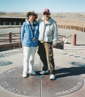


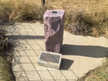


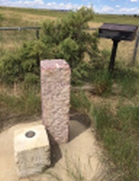


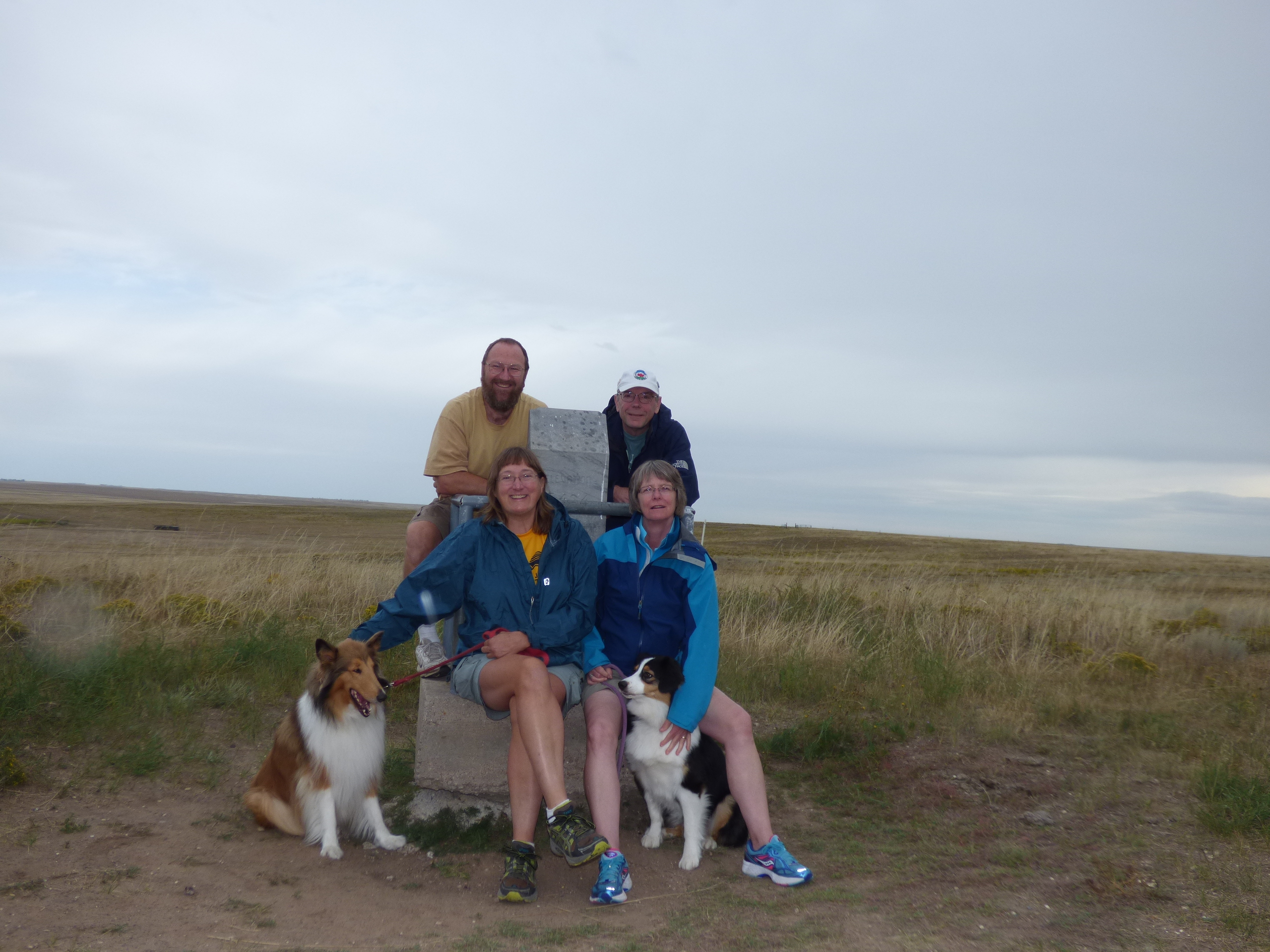


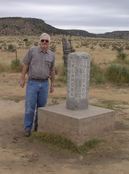

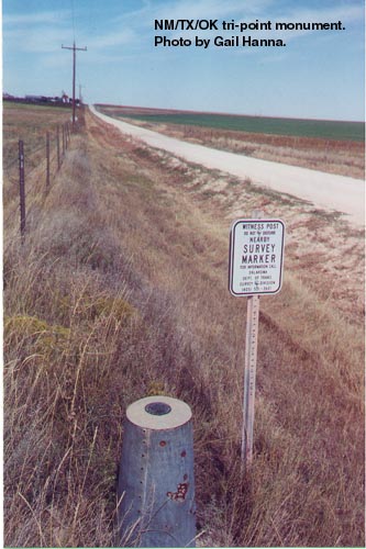

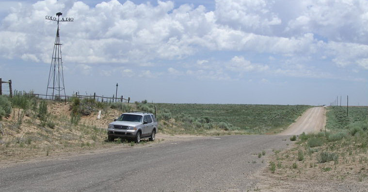


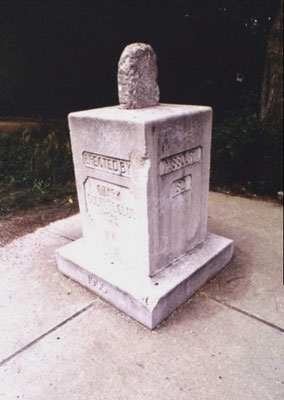

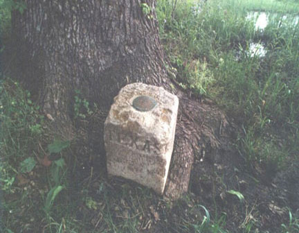


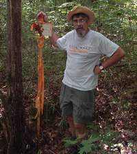


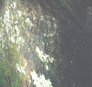


.")