 | ||
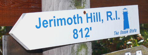
 | Elevation: | 812ft / 247m |
| Difficulty: | Martin=1(b), YDS=1, COHP=0 | |
| Gain & R/T-Dist: | < 10ft & 0mi | |
| Prominence: | 192ft / 58m Ridge 49mi / 79km | |
| Isolation: | 13mi / 21km | |
| Dominance: | 23.65 altitude class 0L | |
| Steepness ∠: | 1.795° @100m, 1.522° @800m | |
| Lat/Lon (WGS84): | 41°50'57.65" N, 71°46'44.03" W | |
| 41.849347, -71.778896 | ||
| 19T 269306 4636784 | ||
| Lat/Lon (NAD27): | 41°50'57.72" N, 71°46'45.87" W | |
| 41.849367, -71.779407 | ||
| 19T 269258 4636574 | ||
| What3Words: | ravens.clumped.inch | |
| MapCode: | US-RI 15.QVB-N | |
| Maidenhead: | FN41cu63mu | |
| PlusCode: | 87HCR6XC+PCQV | |
| Geohash | geo32:drkyndknn7xy, geo36:9LLrq5KWg9 | |
USGS Quadrangle: East Killingly (CT) (large ZIP/PDF)
Time Zone:
Maps:
360° Views:
Visible Summits: PeakFinder, HeyWhatsThat
GSphere:

Photos:
Webcams:
Weather:
NWS Forecast, Mtn-Forecast, NOAA Snow Depth
Severe Weather: national and local
Historical Weather: WeatherSpark, weather.com
Severe Weather: national and local
Historical Weather: WeatherSpark, weather.com
10-day:
[Foster] Wunderground, Accuweather+UV
Warning:
Storms:
Flooding:
UV Index:
Fire:
Winter:
Aurora:
Planets:
CalSKY:
Satellites:
Airplanes:
Cell Phone:
CellMapper: AT+T, Sprint, T-Mobile, Verizon
Vendor: AT+T, Sprint, T-Mobile, Verizon
OpenSignal, WhistleOut
Vendor: AT+T, Sprint, T-Mobile, Verizon
OpenSignal, WhistleOut
HAM Radio:
ITU: Rgn=02 Zone=08, CQ-Zone=05, CallSign=W1, GridSquare FN41cu
On The Air:
Repeaters:
RepeaterBook (table), LevineCentral (map)
More Info:
Wikipedia:
Twitter:
Instagram:
| Geology | Class Type of Material | Type Earth Material | Age | Landform Physiographic Province |
|---|---|---|---|---|
| Highpoint Geology | Metamorphic | Gneiss | Precambrian | Ridge |
| CEPS UNH | Metamorphic | Gneiss | Late Proterozoic | Avalonian Platform |
Nearby Stuff:
Airports:
Atlas Obscura:
Geocaching:
Historic Sites:
National: [Rhode Island], [Providence County] Wikimapia
State/Local: [Rhode Island], [Providence County]
State/Local: [Rhode Island], [Providence County]
Megaliths:
89mi/143km - Mount Frissell-South Slope, CT
89mi/144km - Mount Greylock, MA
153mi/247km - High Point, NJ
169mi/272km - Mount Washington, NH
190mi/306km - Mount Marcy, NY
193mi/311km - Mount Mansfield, VT
240mi/386km - Ebright Azimuth, DE
Nearby Lowpoints:
33mi/53km - Atlantic Ocean, RI
55mi/89km - Atlantic Ocean, MA
70mi/113km - Long Island Sound, CT
99mi/160km - Atlantic Ocean, NH
131mi/211km - Atlantic Ocean, NY
150mi/241km - Atlantic Ocean, NJ
201mi/323km - Lake Champlain, VT
237mi/382km - Delaware River, PA
273mi/440km - Atlantic Ocean, DE
273mi/440km - Atlantic Ocean, ME
300mi/483km - Atlantic Ocean, MD
Nearby Tripoints:
11mi/18km - #38 CT-MA-RI
39mi/62km - #74 CT-NY-RI
70mi/112km - #37 MA-NH-VT
89mi/143km - #35 CT-MA-NY
98mi/158km - #36 MA-NY-VT
155mi/249km - #34 NJ-NY-PA
219mi/353km - #116 NH-QC-VT
232mi/373km - #115 NY-QC-VT
237mi/381km - #73 DE-NJ-PA
241mi/388km - #117 ME-NH-QC
256mi/412km - #33 DE-MD-PA
262mi/421km - #114 NY-ON-QC
Newsletter articles:
• #70-3q05-p28 [Dave Covill] New Owners - Jeff and Debbie Mosley
• #70-3q05-p40-41 [Dave Covill] Improvements - new trails, new signs, new register
• #85-2q09-p9 [Stony Burk] Mosley Property is Now State Owned
• #94-3q11-p29 [Steve Gruhn] First Recorded Ascents of State Highpoints
• #99-4q12-p8 [Jerry Brekhus] Highest Hills
• #99-4q12-p8 [James Suits] 360deg Panoramic Highpoint Photography
• #105-2q14-p13 [Connie Ricca] State highpoint photos - local.msn.com/outdoors/highest-points-in-each-state
• #107-4q14-p8 [Dave Covill] Jerimoth Hill Access, 1999-2014
• #107-4q14-p9 [John Mitchler] Rhode Island Highpoint Now Owned by the Public
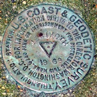
• #109-2q15-p24-27 [Rick Hartman] Benchmarks
• #117-2q17-p27-31 [Lanny Wexler] The Origin of State Highpoint Names
Newsletter updates:
• #105-2q14-p13 [John Mitchler] Photos of new register and logbook
• #107-4q14-p7-9,11,13 [John Mitchler] Ownership changes to Brown University
• #114-3q16-p22 [John Mitchler] http://www.iamlubos.com/highpoints/
• #117-2q17-p19 [John Mitchler] Public access hours