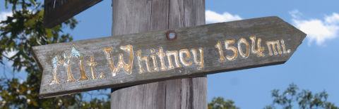
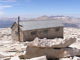
 | Mount Whitney, CA - FS Highpoint of Continental US Highpoint of [Helman] Inyo County, CA Highpoint of Tulare County, CA Highpoint of Sequoia NP |
|
  | Elevation: | 14,494ft / 4,418m |
| Difficulty: | Martin=7, YDS=1, COHP=1 | |
| Gain & R/T-Dist: | 6,750ft & 21mi | |
| Prominence: | 10,078ft / 3,072m Ridge 6,084mi / 9,790km | |
| Isolation: | 1,648mi / 2,652km | |
| Dominance: | 69.53 altitude class 6H | |
| Steepness ∠: | 42.494° @100m, 28.071° @800m | |
| Lat/Lon (WGS84): | 36°34'43.13" N, 118°17'31.68" W | |
| 36.578646, -118.292133 | ||
| 11S 384397 4048909 | ||
| Lat/Lon (NAD27): | 36°34'43.27" N, 118°17'28.35" W | |
| 36.578686, -118.291207 | ||
| 11S 384477 4048710 | ||
| Twsp Rng Sect: | Mount Diablo T16S R34E S5 | |
| What3Words: | unfunny.dramatically.dated | |
| MapCode: | US-CA 93M5.FZ4-Q | |
| Maidenhead: | DM06un48wv | |
| PlusCode: | 8583HPH5+F45W | |
| Geohash | geo32:9qebh4yq19bd, geo36:9nN2jrPRF4 | |
USGS Quadrangle: Mount Whitney (large ZIP/PDF)
Time Zone:
Maps:
360° Views:
Visible Summits: PeakFinder, HeyWhatsThat
Panorama:

GSphere:

Photos:
Webcams:
Weather:
NWS Forecast, Mtn-Forecast, NOAA Snow Depth, Wx-WX6HNX-11
Severe Weather: national and local
Historical Weather: WeatherSpark, weather.com
Severe Weather: national and local
Historical Weather: WeatherSpark, weather.com
10-day:
[Lone Pine] Wunderground, Accuweather+UV
Warning:
Storms:
Flooding:
UV Index:
Fire:
Planets:
CalSKY:
Satellites:
Airplanes:
Cell Phone:
CellMapper: AT+T, Sprint, T-Mobile, Verizon
Vendor: AT+T, Sprint, T-Mobile, Verizon
OpenSignal, WhistleOut
Vendor: AT+T, Sprint, T-Mobile, Verizon
OpenSignal, WhistleOut
HAM Radio:
ITU: Rgn=02 Zone=06, CQ-Zone=03, CallSign=W6, GridSquare DM06un
On The Air:
Repeaters:
RepeaterBook (table), LevineCentral (map)
More Info:
Wikipedia:
Instagram:
| Geology | Class Type of Material | Type Earth Material | Age | Landform Physiographic Province |
|---|---|---|---|---|
| Highpoint Geology | Igneous | Granite | Cretaceous | Massif |
| CEPS UNH | Intrusive | Granite | Cretaceous | Sierra Nevada |
Nearby Stuff:
Airports:
Atlas Obscura:
Deg Confluence:
Geocaching:
Historic Sites:
Megaliths:
88mi/141km - Boundary Peak, NV
Nearby Lowpoints:
85mi/136km - Badwater Basin, CA
232mi/374km - Colorado River, NV
239mi/385km - Beaver Dam Wash, UT
Nearby Tripoints:
232mi/374km - #52 AZ-CA-NV
237mi/381km - #4 AZ-NV-UT
Newsletter articles:
• #79-4q07-p26-27 [Dough Thompson] The Big One in One Day
• #86-3q09-p16-17 [Tom Martin] Acute Mountain Sickness
• #94-3q11-p29 [Steve Gruhn] First Recorded Ascents of State Highpoints
• #99-4q12-p8 [Jerry Brekhus] Highest Hills
• #99-4q12-p8 [James Suits] 360deg Panoramic Highpoint Photography
• #104-1q14-p24-25 [Steve Fuglestad] The Badwater Basin to Mount Whitney Expedition
• #105-2q14-p13 [Connie Ricca] State highpoint photos - local.msn.com/outdoors/highest-points-in-each-state
• #106-3q14-p6-7 [Doug Thompson] The Big One in One Day with 2014 updates
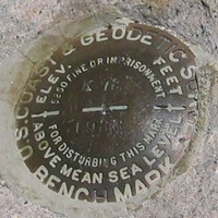
• #109-2q15-p24-27 [Rick Hartman] Benchmarks
• #117-2q17-p27-31 [Lanny Wexler] The Origin of State Highpoint Names
• #119-4q17-p22-23 [Jane Bertrand] Logistics of Clinbing Whitney with a Guide
Newsletter updates:
• #109-2q15-p11 [John Mitchler] What to do if no permits are available
• #110-3q15-p10 [Yahoo Group] What to do if no permits are available
• #112-1q16-p5 [Stony Burk] Mt Whitney twitter feed
• #112-1q16-p5 [John Mitchler] Lottery statistics and popular dates
• #114-3q16-p22 [Rick Hartman] Picking up permits
• #114-3q16-p22 [John Mitchler] http://www.iamlubos.com/highpoints/
• #117-2q17-p18 [Rob M] Vandalism - photo
• #117-2q17-p18 [Stu Fink, Paul M] Trip report
• #118-3q17-p27 [John Mitchler] Latest trail conditions