 |
|
PID=CE0665 (NGS Datasheet)
Maps: [Sat] Google, Bing [Topo] Acme, Gmap4 MyTopo [Peaks] ListOfJohn, Summitpost
Photos: Flickr, Loc.alize.us, Bing, Google
Videos: Vimeo, Youtube
Weather: NWS Forecase, NOAA Snow Depth
Nearby POI: Opencaching.us, Waymarking.com
Nearby Highpoints:
98mi/158km - Guadalupe Peak, TX
Nearby Lowpoints:
150mi/242km - Red Bluff Reservoir, NM
Nearby Tripoints:
135mi/217km - #154 CHH-NM-SON
152mi/244km - #153 AZ-NM-SON
272mi/437km - #156 CHH-COA-TX
HPC Forum: #155 CHH-NM-TX
Newsletter index:
• #105-14q2 p17 [Andy Martin] CHH-NM-TX directions and photo
Trip Report - 2006 - Victor Cantore
You can view the trip report at Yahoo Group! BoundaryPoint.
Newsletter - #105-14q2-p17 - Andy Martin
 |
 |
 |
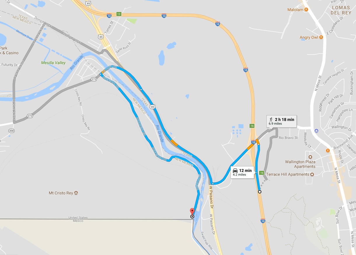
The last couple of miles is on deteriorating pavement or dirt through an industrial area - not exactly welcoming territory.
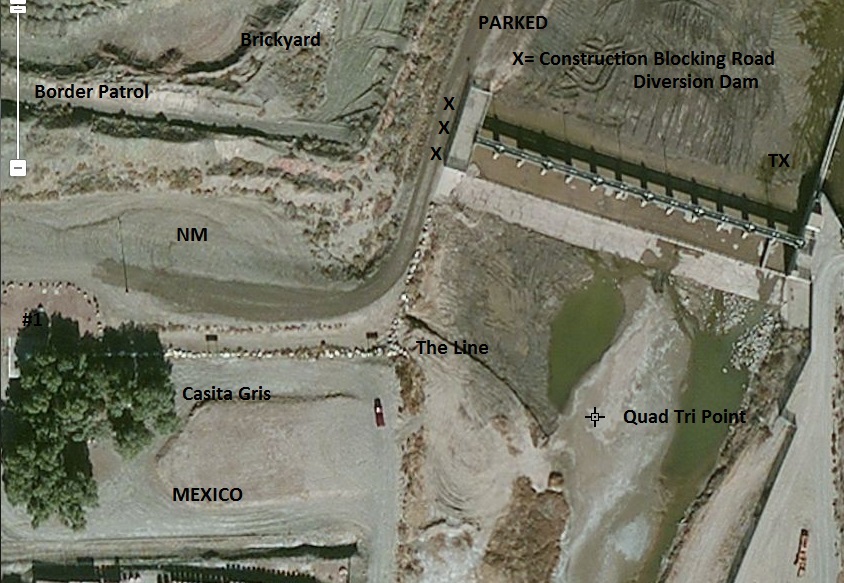
The last section of road was blocked by construction activity (XXX on aerial photo), so I parked in the middle of the road and walked past the construction area to the border line.
There are postings to the left and right of this route, and I'm not sure it is OK to walk where I did, so this area is certainly off the "tourist trail" at the moment.
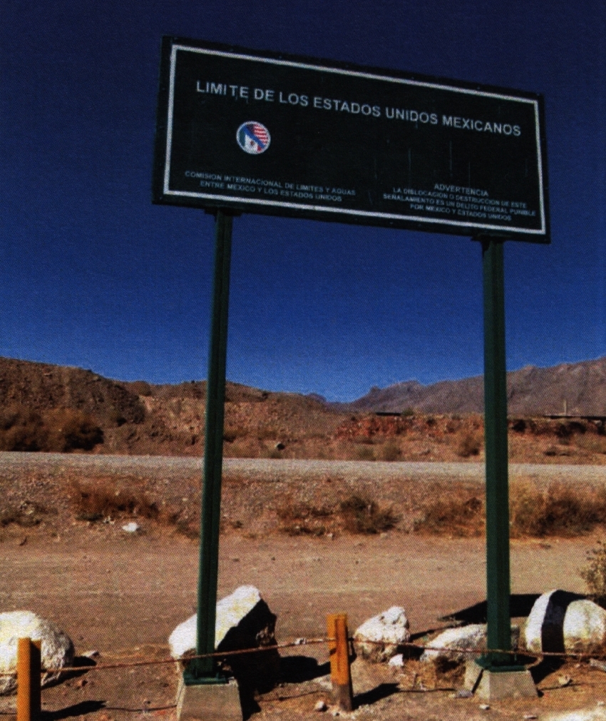
The border line is clearly marked by large white rocks and tall green signs. The photo of the sign is looking north. In the picture [Ed: annotated aerial photo - #1 on left-hand side] is a white obelisk which is boder monument #1. I visited this, and had a friendly chat with a Mexican man and some children at the monument. We literally shook hands across the border. He had a large interesting panoramic photo of the location taken in 1911. [In the aerial photo] The reconstructed "La Casita Gris" [Ed: now the museum Casa de Adobe] was [Ed: UTEP source now off-line] "In April 1911, an adobe building a few yards away from Marker #1 where Francisco Madero set up his headquarters served as the provisional capital of Mexico." [Ed: you may be interested in slides 6-10 from the IBWC's "Projects along the US-Mexico Border" (large PDF) for old photos and more information].
I next attempted to walk the border line east to Texas, in theory at some point a walker should cross the tri-point. Unfortunately when the line reached the former Rio Grande river bed I encountered a high growth of bamboo or cane vegetation. The footing was marshy, and I worried about stepping into hidden mud.
Crossing the line south into Mexico would have helped get further east, and then perhaps back north to the line. However I was worried about the border patrol citing me for illegal entry. I estimate the tri-point was 60 feet east of my stopping point. A more dedicated individual would have proceeded through the vegetation, so my visit is certainly flawed - the tri-point tribunal will have to pass judgement on this attempted visit :)