 |
|
PIDs=GL1538, AA7182 (NGS Datasheet)
Maps: [Sat] Google, Bing [Topo] Acme, Gmap4 MyTopo [Peaks] ListOfJohn, Summitpost
Photos: Flickr, Loc.alize.us, Bing, Google
Videos: Vimeo, Youtube
Weather: NWS Forecase, NOAA Snow Depth
Nearby POI: Opencaching.us, Waymarking.com
Nearby Highpoints:
53mi/85km - Black Mesa, OK
140mi/226km - Mount Sunflower, KS
189mi/304km - Wheeler Peak, NM
281mi/452km - Mount Elbert, CO
297mi/478km - Panorama Point, NE
Nearby Lowpoints:
206mi/332km - Arikaree River, CO
Nearby Tripoints:
53mi/85km - #14 CO-NM-OK
63mi/102km - #15 NM-OK-TX
208mi/335km - #13 CO-KS-NE
297mi/478km - #12 CO-NE-WY
The Corner Corner: http://www.bjbsoftware.com/corners/pointdetail.php3?point=15
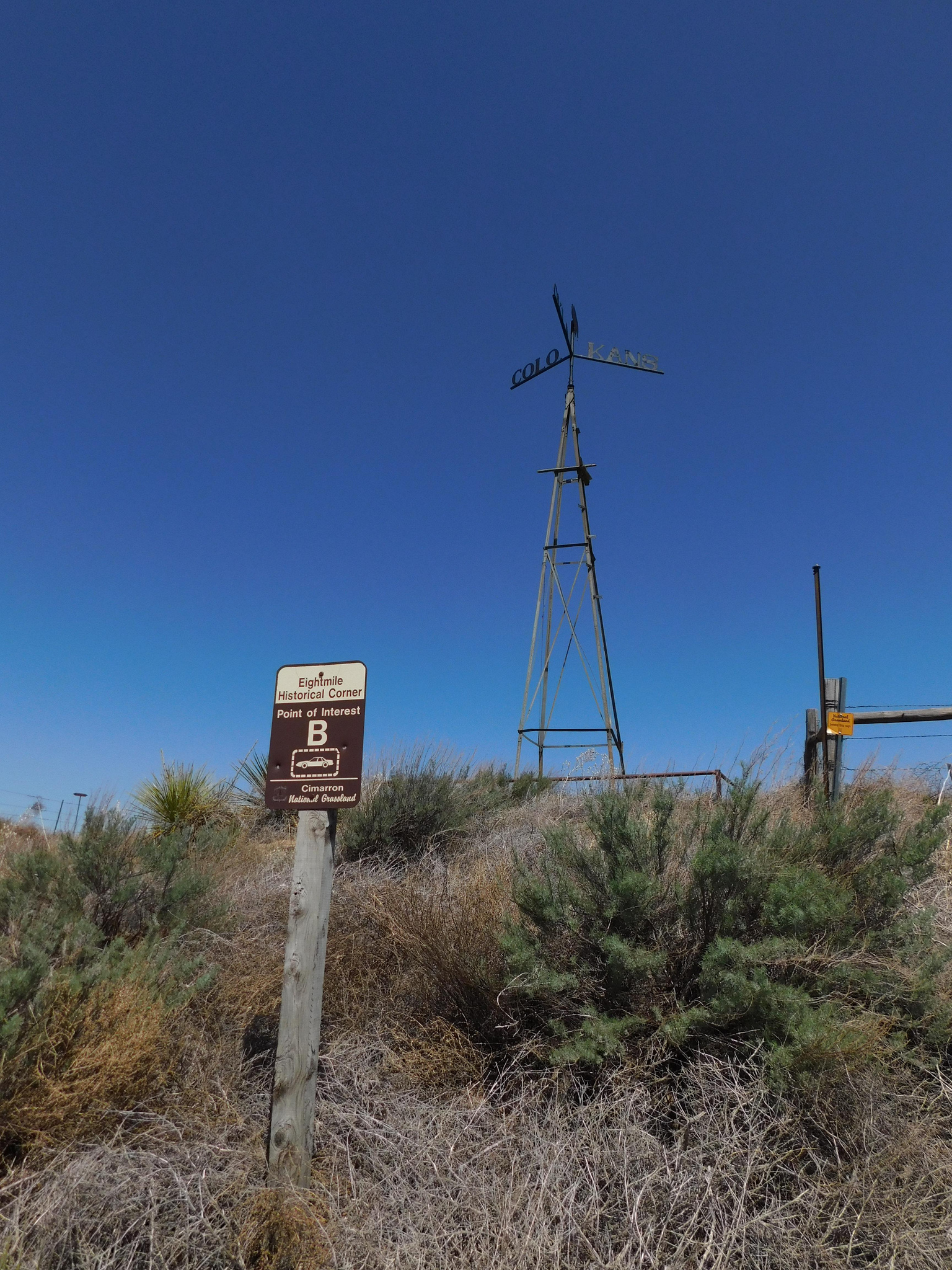
Wikipedia notes: 8 Mile Corner. Marker is concealed in crypt beneath removable manhole cover.
Wiki article: 8_Mile_Corner
HPC Forum: #16 CO-KS-OK
Trip Report - Nov 20, 1990 - Jack Parsell
 |
 |
 |
On Jan. 29, 1861, when Kansas was admitted to the Union, the 25th meridian W of Washington, DC was established as the W boundary of KS. Colorado was organized as a territory on Feb. 28, 1861 with the same boundaries as at present, being made up from parts of the Territories of UT, NM, KS and NE. Earlier in 1858 a concerted attempt had been made to organize the "State of Jefferson" in this area, but by popular vote in 1859 it was decided to organize a Territorial government instead. The S boundary on the 37th parallel had been established by the Macomb survey of 1858-59. The CO - OK portion of the 37th parallel was resurveyed by John G. Major in 1873-74. Dates on the tri-point marker are the years each of the states was admitted to the union.
History of Tripoint and Trip Report - Oct, 1995 - Dale Sanderson
Dale Sanderson provides history on locating the tripoint at US Ends along with his trip report.
Trip Report - June 15, 2009 - Roger Simpson
You can view the trip report at "Simpson Family OK trip".
Trip Report - Oct 30, 2016 - Mick Dunn and Ruth Anne Heselbarth
You can view the trip report on Facebook [FB account required].
 [Ed: A snippet of the trip report follows. Please see FB for all the photos and descriptions detailing where the tri-point is located]. This is the Colorado/Kansas/Oklahoma tri-point. It was the third of three that we went to during the last weekend of October and is fairly easy to find. Just be sure that your GPS is not filtering out the use of dirt roads. October 30th, 2016.