 |
|
PIDs=GA3599, GA3598 (NGS Datasheet)
Maps: [Sat] Google, Bing [Topo] Acme, Gmap4 MyTopo [Peaks] ListOfJohn, Summitpost
Photos: Flickr, Loc.alize.us, Bing, Google
Videos: Vimeo, Youtube
Weather: NWS Forecase, NOAA Snow Depth
Nearby POI: Opencaching.us, Waymarking.com
Nearby Highpoints:
48mi/78km - Black Mountain, KY
73mi/117km - Clingmans Dome, TN
98mi/157km - Mount Mitchell, NC
117mi/189km - Sassafras Mountain, SC
118mi/190km - Mount Rogers, VA
119mi/192km - Brasstown Bald, GA
244mi/392km - Hoosier High Point, IN
247mi/397km - Cheaha Mountain, AL
260mi/419km - Campbell Hill, OH
269mi/433km - Spruce Knob, WV
285mi/458km - Backbone Mountain (Hoye Crest), MD
285mi/459km - Woodall Mountain, MS
Nearby Lowpoints:
184mi/296km - Ohio River, OH
253mi/407km - Ohio River, IN
303mi/488km - Mississippi River, IL
Nearby Tripoints:
111mi/178km - #28 NC-TN-VA
114mi/184km - #29 KY-VA-WV
115mi/185km - #26 GA-NC-SC
117mi/189km - #25 GA-NC-TN
139mi/224km - #71 KY-OH-WV
155mi/250km - #23 AL-GA-TN
184mi/296km - #70 IN-KY-OH
254mi/408km - #69 IL-IN-KY
277mi/445km - #66 AL-MS-TN
303mi/488km - #61 IL-KY-MO
The Corner Corner: http://www.bjbsoftware.com/corners/pointdetail.php3?point=51
Wikipedia notes: Tri-State Peak is located within Cuberland Gap National Historical Park.
Wiki article: Tri-State_Peak
HPC Forum: #27 KY-TN-VA
Newsletter index:
• #69-05q2 p26 [Bob Whitney] GA-KY-VA notes
• #103-13q4 p33 [Bill Wentzel] KY-TN-VA monument 'the best' with photo
Trip Report - May 20, 1991 - Jack Parsell
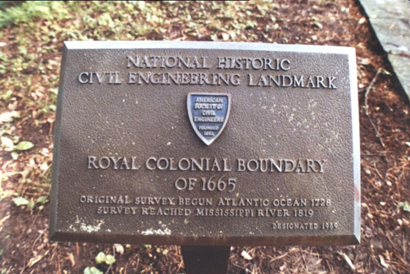
 ACCESS ROUTE: This site is close to Cumberland Gap. Route 25 has been rerouted and goes through a tunnel under the Gap. Park Service personnel told Richard Carey in May 2000 that old Route 25 will be torn up, the power lines removed and the old trail restored to its 1775 condition. From the visitors center drive E toward Pinnacle Overlook for 1.3 mi. to a right turn at a junction toward Sugar Run. Park at the concrete barricade about l00 yds. from the junction. Walk about 1/3 mile up to the gap and the sign for the tri-point trail. Continue on to the tri-State point which is in a park-like setting. There are long strips of concrete coming together in a slightly off 90 degree tee, the junction being at the tri-point. There is also a bronze plaque certifying this point as a National Historic Civil Engineering Landmark. This point was on the Royal Colonial Boundary of 1665. The first survey began at the Atlantic Ocean in 1728, and reached the Mississippi River in 1819.
On your way to or from this tri-point, there is an interesting side trail which will take you to the remains of a Civil War fort.
Update - Summer, 2006 - Bob Whitney
[Ed: also published in #69-05q2-p25].
Visit the National Park Visitor Center to obtain a map showing revised trails, tied in with the construction of the Cumberland Gap Tunnel.
Update - ??? - Richard L Carey
You can view the trip report at Peakbagging
Update - Nov 30, 2012 - Jimmy Emerson
Jimmy Emerson has several photos on Flickr with some descriptions. You can start with this one and the 13 previous [reverse order] photos.