


The Highpointers Club doesn’t have a definitive online guide. There are plenty of books available at the Highpointers Merc including guidebooks by HPC members: Holmes, Wingers, and Zumwalt. Sources with current information are two interactive sites: summitpost.org and wikipedia.org. Summitpost is the definitive choice among climbers, although wikipedia has some amazing information on the mountains. The Highpointers Club maintains that the USGS Elevations and Distances is the official source for the Club. More details about adjustments to this list are described in “State Highpoints Recognized by the Club“.
David Kelly has produced two ARCSOFT interactive topo maps: State Highpoints and County Highpoints.
Please contact us at guides@highpointers.org if you have any suggestions for enhancing this guide.
- Martin Classification details can be found here. (w) – indicates wheelchair access to peak
- YDS Classification details can be found here
Besides the summary table below, we have expanded difficulty measures, prominence/isolation and steepness tables.
(You may re-sort this table by clicking the small arrows found in the column headers.)
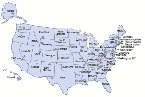
- State – the link goes to Wikipedia
- Highpoint – the link goes to Summitpost
- Date – the date the state was admitted to the union
- Access – the type of access restriction for this peak; the link provides details
- Elev – the elevation in feet; the link goes to our forum
- Martin – the Martin classification
- Gain – the elevation gain in feet. note that “10” is really “< 10”
- Hike – the round-trip distance in miles. note that “0.0” is really “< 0.1”
| State | Highpoint | Date | Access | Elev | Martin | Gain |
|---|---|---|---|---|---|---|
| Alabama | Cheaha Mountain | 14/12/1819 | 2,41 | 1(w) | 10,00 | |
| Alaska | Denali (Mount McKinley) | 03/01/1959 | NPS | 20,32 | 10 | 24,50 |
| Arizona | Humphreys Peak | 14/02/1912 | 12,63 | 6 | 3,50 | |
| Arkansas | Magazine Mountain (Signal Hill) | 15/06/1836 | 2,75 | 2 | 225,00 | |
| California | Mount Whitney | 09/09/1850 | FS | 14,49 | 7 | 6,75 |
| Colorado | Mount Elbert | 01/08/1876 | 14,43 | 6 | 5,00 | |
| Connecticut | Mount Frissell-South Slope | 09/01/1788 | 2,38 | 3 | 450,00 | |
| Delaware | Ebright Azimuth | 07/12/1787 | 448,00 | 1(w) | 10,00 | |
| Florida | Britton Hill | 03/03/1845 | 345,00 | 1(w) | 10,00 | |
| Georgia | Brasstown Bald | 02/01/1788 | 4,78 | 2(w) | 400,00 | |
| Hawaii | Mauna Kea (Pu’u Wekiu) | 21/08/1959 | R | 13,80 | 2 | 230,00 |
| Idaho | Borah Peak | 03/07/1890 | 12,66 | 8 | 5,50 | |
| Illinois | Charles Mound | 03/12/1818 | Pvt | 1,24 | 2 | 275,00 |
| Indiana | Hoosier High Point | 11/12/1816 | Pvt | 1,26 | 1(b) | 10,00 |
| Iowa | Hawkeye Point | 28/12/1846 | 1,67 | 1(w) | 10,00 | |
| Kansas | Mount Sunflower | 29/01/1861 | Pvt | 4,04 | 1(w) | 10,00 |
| Kentucky | Black Mountain | 01/06/1792 | Pvt | 4,15 | 1(w) | 10,00 |
| Louisiana | Driskill Mountain | 30/04/1812 | Pvt | 535,00 | 2 | 150,00 |
| Maine | Mount Katahdin (Baxter Peak) | 15/03/1820 | SP | 5,27 | 5 | 4,20 |
| Maryland | Backbone Mountain (Hoye Crest) | 28/04/1788 | 3,36 | 3 | 750,00 | |
| Massachusetts | Mount Greylock | 06/02/1788 | 3,49 | 1(w) | 20,00 | |
| Michigan | Mount Arvon | 26/01/1837 | Pvt | 1,98 | 1(w) | 10,00 |
| Minnesota | Eagle Mountain | 11/05/1858 | 2,30 | 4 | 600,00 | |
| Mississippi | Woodall Mountain | 10/12/1817 | Pvt | 806,00 | 1(w) | 10,00 |
| Missouri | Taum Sauk Mountain | 10/08/1821 | 1,77 | 1(w) | 30,00 | |
| Montana | Granite Peak | 08/11/1889 | 12,80 | 9 | 7,70 | |
| Nebraska | Panorama Point | 01/03/1867 | Pvt | 5,42 | 1(w) | 10,00 |
| Nevada | Boundary Peak | 31/10/1864 | 13,14 | 6 | 4,40 | |
| New Hampshire | Mount Washington | 21/06/1788 | 6,29 | 1 | 20,00 | |
| New Jersey | High Point | 18/12/1787 | 1,80 | 1(w) | 40,00 | |
| New Mexico | Wheeler Peak | 06/01/1912 | 13,16 | 6 | 3,25 | |
| New York | Mount Marcy | 26/07/1788 | DEC | 5,34 | 5 | 3,20 |
| North Carolina | Mount Mitchell | 21/11/1789 | 6,68 | 1(w) | 100,00 | |
| North Dakota | White Butte | 02/11/1889 | 3,51 | 2 | 400,00 | |
| Ohio | Campbell Hill | 01/03/1803 | Pvt | 1,55 | 1(w) | 10,00 |
| Oklahoma | Black Mesa | 16/11/1907 | 4,97 | 4 | 775,00 | |
| Oregon | Mount Hood | 14/02/1859 | FS | 11,24 | 8 | 5,30 |
| Pennsylvania | Mount Davis | 12/12/1787 | 3,21 | 1(w) | 10,00 | |
| Rhode Island | Jerimoth Hill | 29/05/1790 | 812,00 | 1(b) | 10,00 | |
| South Carolina | Sassafras Mountain | 23/05/1788 | 3,56 | 1(w) | 10,00 | |
| South Dakota | Black Elk Peak (Harney Peak) | 02/11/1889 | 7,24 | 4 | 1,50 | |
| Tennessee | Clingmans Dome | 01/06/1796 | 6,64 | 2(w) | 330,00 | |
| Texas | Guadalupe Peak | 29/12/1845 | 8,75 | 5 | 2,95 | |
| Utah | Kings Peak | 04/01/1896 | 13,53 | 7 | 5,35 | |
| Vermont | Mount Mansfield | 04/03/1791 | R | 4,39 | 3 | 550,00 |
| Virginia | Mount Rogers | 25/06/1788 | 5,73 | 4 | 1,50 | |
| Washington | Mount Rainier | 11/11/1889 | NPS | 14,41 | 9 | 9,10 |
| West Virginia | Spruce Knob | 20/06/1863 | 4,86 | 1(w) | 20,00 | |
| Wisconsin | Timms Hill | 29/05/1848 | 1,95 | 1 | 120,00 | |
| Wyoming | Gannett Peak | 10/07/1890 | 13,80 | 9 | 8,65 | |
| District of Columbia | Point Reno | 16/07/1790 | 410,00 | 1 | 10,00 | |
| American Samoa | Lata Mountain | 02/08/2026 | 3,16 | 4 | 3,16 | |
| Guam | Mount Lamlam | 02/08/1899 | 1,33 | 3 | 710,00 | |
| Northern Marianas Is | Agrihan | 02/08/1978 | 3,17 | 6 | 3,17 | |
| Puerto Rico | Cerro de Punta | 02/08/1899 | 4,39 | 1 | 615,00 | |
| US Virgin Is | Crown Mountain | 02/08/2026 | Pvt | 1,56 | 1 | 10,00 |
You may also be interested in the US Territory Guide which gives more details on the District of Columbia and US territories, commonwealths, possessions and free associated states.